



CLEVELAND — More picture-perfect weather will continue across Northeast Ohio on Monday. Temperatures will be a touch warmer, with many in the upper 70s by Monday afternoon, under partly cloudy skies.
Power of 5 Regions highlight: Cleveland Metro Region
We're going to focus on the Cleveland Metro, as the Air Show will be in town on Labor Day. And, boy, is it going to be a fantastic day for the final day of the 2026 show to enjoy! Temperatures will top off closer to 80 Monday afternoon, under partly cloudy skies. Winds will be brisk, with northeast winds between 10 and 15 mph. Keep the sunscreen and sunglasses handy if you're heading down to the show!
Looking Ahead:
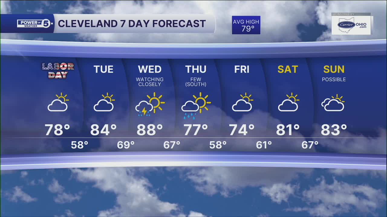
Dry conditions will continue for all of Northeast Ohio through at least Wednesday morning. Temperatures will continue to climb through this stretch, returning to the 80s on Tuesday and approaching 90 degrees on Wednesday.
Shower and storm chances will return on Wednesday, primarily during the afternoon, and chances continue on Thursday. Cooler, Fall-like air will move in again by the end of the week, with highs in the lower 70s by Friday.
5-Day Forecast
Labor Day: Mostly dry & touch warmer. Partly cloudy. | High: 78º
Tuesday: Warmer with Humidity Building. | High: 83º
Wednesday: Hot and humid. Chance of storms. | High: 88º
Thursday: Cooler. Few showers, especially south. | High: 77º
Friday: Cool. Partly cloudy. | High: 73º
Learn the lingo: The Power of 5 Weather Team wants to get you your forecast closer to home. We have broken NEO into 5 separate and distinct regions. Find your region to get your hyper-local forecast!
- Cleveland Metro Region: Cuyahoga County. This region includes cities such as Cleveland, Parma, Westlake, Berea, Strongsville, Independence, Solon, Beachwood, and Euclid.
- Snowbelt Region: Lake, Geauga, and Ashtabula Counties. This includes cities such as Mentor, Geneva, Ashtabula, Bainbridge, Chardon, Burton, and Orwell.
- Akron-Canton Region: Summit, Stark, and Portage Counties. This region includes cities such as Akron, Canton, Hudson, Ravenna, Mantua, Alliance, and Canal Fulton.
- West Region: Lorain, Medina, Erie, Huron, Richland, and Ashland Counties. This region includes cities such as Lorain, Wellington, Medina, Lodi, Ashland, Mansfield, Willard, and Sandusky.
- South Region: Wayne, Holmes, Tuscarawas, Carroll Counties. This region includes Wooster, Millersburg, New Philadelphia, Strasburg, Mineral City, Carrollton, and Newcomerstown
You can send us photos and short videos by filling out the form below:
Want the latest Power of 5 weather team updates wherever you go? Download the News 5 App free now: Apple|Android
Click here to view our interactive radar.
Follow the News 5 Weather Team:
Trent Magill: Facebook & Twitter
Katie McGraw: Facebook & Twitter
Phil Sakal: Facebook & Twitter
Allan Nosoff: Facebook & Twitter
