



CLEVELAND — Steamy and stormy. That's the name of the weather game for the next few days. It will not be a washout any day, but on-and-off showers and storms are expected throughout the entire workweek. Rain chances increase this evening, but continue to look light. More showers and storms are possible Tuesday morning. Tuesday morning's rain could be heavier with more thunder/lightning and could make the morning commute a bit slower. A few stronger wind gusts will be possible along with heavy rain. Rain chances look to drop midday Tuesday, before another round of storms overnight Tuesday into Wednesday morning.
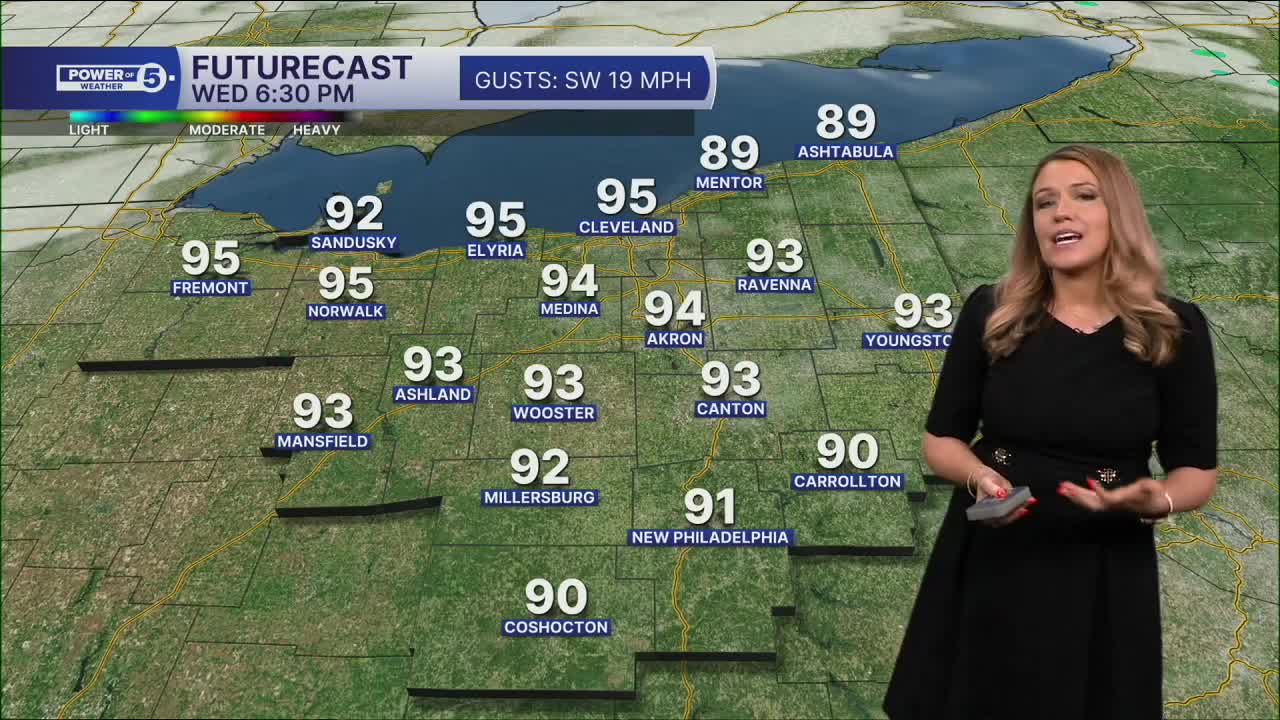
In the meantime, heat is also building! Monday was about 10 degrees warmer than Sunday, and it looks like it will get even hotter on Tuesday, with temperatures around 90 degrees and plenty of humidity. The hottest day should be Wednesday. A heat advisory has been issued for about half of our viewing area. Heat indices are expected to climb to the upper 90s and low 100s.
Power of 5 Regions highlight: West Region:
The hottest feels-like temperatures are expected across the West Region on Tuesday and Wednesday. The entire region is included in the heat advisory along with CLE Metro/Cuyahoga County, Summit County, and Wayne County. Plan for high heat and humidity the next two days. Stay cool!
Looking ahead:
It remains unsettled through the rest of the week. A cold front will move through NEO by the end of the week, with lingering storm chances on Thursday and Friday. The good news? A cooler air mass looks set to arrive for the holiday weekend along with a gradual drying trend. As of Monday evening, Labor Day is trending dry! We will keep you posted on the holiday weekend forecast.
5-Day Forecast
Monday Night: Showery. Mostly cloudy. Mild & muggy. | Low: 74º
Tuesday: AM Storms. Hot and humid. Isolated PM storm. | High: 89º
Wednesday: Hot and humid. Storms possible. | High: 92º
Thursday: Mostly cloudy. Showers and t-storms likely. | High: 86º
Friday: Scattered t-storms, still steamy. | High: 80º
Learn the lingo: The Power of 5 Weather Team wants to get you your forecast closer to home. We have broken NEO into 5 separate and distinct regions. Find your region to get your hyper-local forecast!
- Cleveland Metro Region: Cuyahoga County. This region includes cities such as Cleveland, Parma, Westlake, Berea, Strongsville, Independence, Solon, Beachwood, and Euclid.
- Snowbelt Region: Lake, Geauga, and Ashtabula Counties. This includes cities such as Mentor, Geneva, Ashtabula, Bainbridge, Chardon, Burton, and Orwell.
- Akron-Canton Region: Summit, Stark, and Portage Counties. This region includes cities such as Akron, Canton, Hudson, Ravenna, Mantua, Alliance, and Canal Fulton.
- West Region: Lorain, Medina, Erie, Huron, Richland, and Ashland Counties. This region includes cities such as Lorain, Wellington, Medina, Lodi, Ashland, Mansfield, Willard, and Sandusky.
- South Region: Wayne, Holmes, Tuscarawas, Carroll Counties. This region includes Wooster, Millersburg, New Philadelphia, Strasburg, Mineral City, Carrollton, and Newcomerstown
Want the latest Power of 5 weather team updates wherever you go? Download the News 5 App free now: Apple|Android
Click here to view our interactive radar.
Follow the News 5 Weather Team:
Trent Magill: Facebook & Twitter
Katie McGraw: Facebook & Twitter
Phil Sakal: Facebook & Twitter
Allan Nosoff: Facebook & Twitter
