


CLEVELAND — Clouds make a return during the overnight and that will help keep temperatures from getting as cold as they were this morning. Lows will be in the mid to upper Teens.
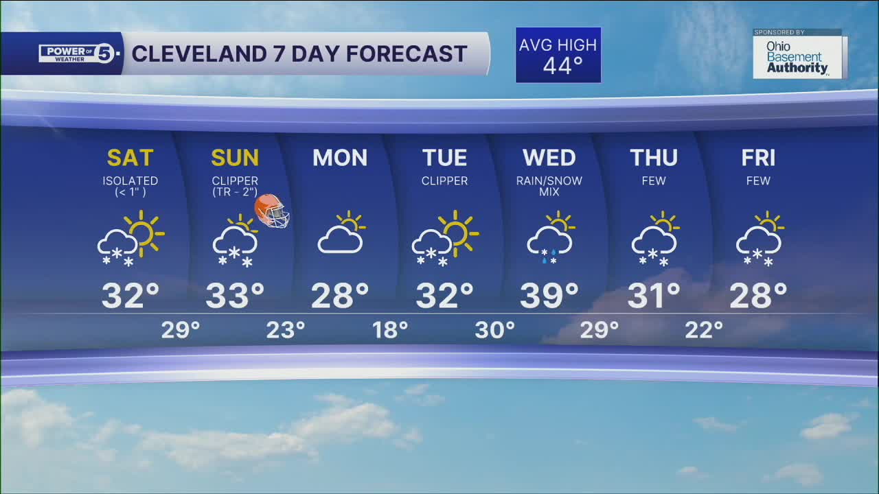
We'll make it closer to 32º Saturday, but we won't be nearly as sunny. We're actually dodging snow showers. We'll have a few slushy snow accumulations of an inch or less if you're north of Akron.
There's another round of snow coming Sunday. That one looks a bit more organized with a better shot at up to 2". We'll be near 32º again so plan on slushy accumulations.
DAILY FORECAST:
Saturday: Cold & breezy with a few snow showers. | High: 32º
Sunday: Snow showers for the Browns game. | High: 33º
Monday: Cold and drier. | High: 28º
Tuesday: Few snow showers. Still cold. | High: 34º
Wednesday: Scattered rain/snow mix. | High: 39º
Thursday: Colder. Few snow showers. | High: 33º
Want the latest Power of 5 weather team updates wherever you go? Download the News 5 App free now: Apple|Android
Click here to view our interactive radar.
Follow the News 5 Weather Team:
Trent Magill: Facebook & Twitter
Katie McGraw: Facebook & Twitter
Phil Sakal: Facebook & Twitter
Allan Nosoff: Facebook & Twitter
