


CLEVELAND — After a chilly and wet start to the day, we are much warmer and drier. Today will be toasty! Temperatures have jumped 30-40 degrees and are in the upper 70s, perhaps even the low 80s, this afternoon. An isolated pop-up storm is possible through this evening. Clouds will also increase this evening, and temperatures will remain mild. A few t-showers are possible overnight into early Friday.
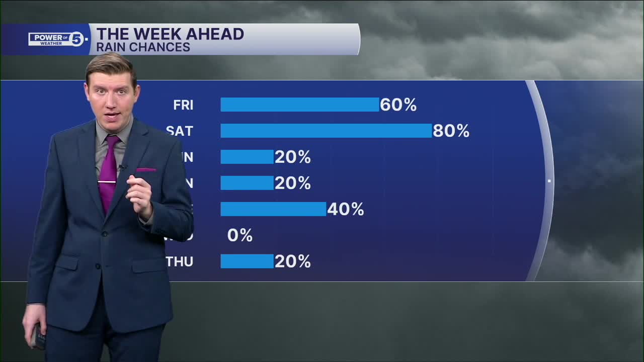
Friday will also be warm with above-average temperatures in the 70s, but the storm chance increases. It does not look like widespread storms, but during the afternoon, storms will start to bubble up. These will be hit-or-miss downpours...and that includes Progressive Field. While it will be mild, grab the poncho, just in case one of these pop-up storms develops over the Guardian's Home Opener. Any storm could become briefly tall and strong and bring gusty winds, heavy rain, and lightning.
Saturday looks even warmer, but the storm chance jumps up again, too. Plan for storms by Saturday afternoon and evening ahead of a cold front. We will be watching for any strong or severe storms once again.
The cold front will drop our temperatures for the second half of the weekend. Easter Sunday is looking chilly with temperatures only in the 40s. The chill should linger into next week as well.
DAILY FORECAST:
Thursday: Isolated T-storms. Warmth returns. | High: 74°
Friday: Spotty downpours. Warmer. | High: 72°
Saturday: Even Warmer. PM storms.| High: 79°
Easter: Colder again.| High: 42°
Monday: Isolated showers, chilly.| High: 43°
Want the latest Power of 5 weather team updates wherever you go? Download the News 5 App free now: Apple|Android
Click here to view our interactive radar.
Follow the News 5 Weather Team:
Trent Magill: Facebook & Twitter
Katie McGraw: Facebook & Twitter
Phil Sakal: Facebook & Twitter
Allan Nosoff: Facebook & Twitter
