



CLEVELAND — After some severe storms for our West and South regions earlier Thursday evening, the severe threat is over. An isolated shower can't be ruled out overnight, and a few more showers are expected during the day Thursday. Key word: showers. Not storms. No severe risk is good news, albeit some after-school plans are in jeopardy, depending on region. Explained more below...
Power of 5 Meteorologist Allan Nosoff was live tracking the storms:
Nosoff was also live earlier tracking a storm at the beginning of the storms.
The Power of 5 forecast
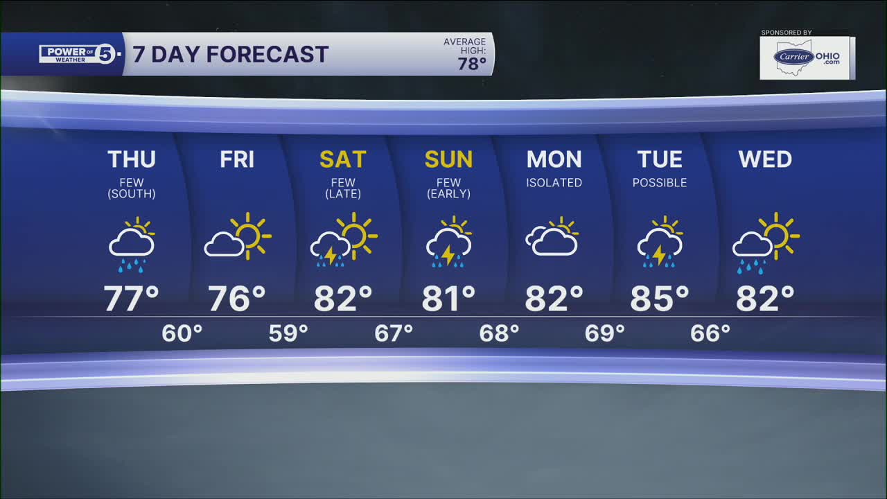
Summer heat is over for now. It will come back to a degree this weekend, but highs will be stuck in the 70s for Thursday and Friday.
A few showers will exit by the evening commute and it will be dry through Saturday evening. Friday will be beautiful with sunshine and upper 70s.
Power of 5 Regions Highlight: South Region
The South region will have the highest chance of residual showers during the day Thursday. It will not be severe, but an inconvenience for travel, including after-school pick-ups and the early evening commute. Best chance between 11 am and 4 pm.
5-Day Forecast
Thursday: Cooler. Few showers, especially south. | High: 76º
Friday: Comfortable. Mostly sunny. | High: 77º
Saturday: Sun to clouds. Storms expected at night. | High: 83º
Sunday: Isolated t-storms early. Warm. | High: 81º
Monday: Partly cloudy. Hotter & more humid. | High: 83º
Learn the lingo: The Power of 5 Weather Team wants to get you your forecast closer to home. We have broken NEO into 5 separate and distinct regions. Find your region to get your hyper-local forecast!
- Cleveland Metro Region: Cuyahoga County. This region includes cities such as Cleveland, Parma, Westlake, Berea, Strongsville, Independence, Solon, Beachwood, and Euclid.
- Snowbelt Region: Lake, Geauga, and Ashtabula Counties. This includes cities such as Mentor, Geneva, Ashtabula, Bainbridge, Chardon, Burton, and Orwell.
- Akron-Canton Region: Summit, Stark, and Portage Counties. This region includes cities such as Akron, Canton, Hudson, Ravenna, Mantua, Alliance, and Canal Fulton.
- West Region: Lorain, Medina, Erie, Huron, Richland, and Ashland Counties. This region includes cities such as Lorain, Wellington, Medina, Lodi, Ashland, Mansfield, Willard, and Sandusky.
- South Region: Wayne, Holmes, Tuscarawas, Carroll Counties. This region includes Wooster, Millersburg, New Philadelphia, Strasburg, Mineral City, Carrollton, and Newcomerstown
You can send us photos and short videos by filling out the form below:
Want the latest Power of 5 weather team updates wherever you go? Download the News 5 App free now: Apple|Android
Click here to view our interactive radar.
Follow the News 5 Weather Team:
Trent Magill: Facebook & Twitter
Katie McGraw: Facebook & Twitter
Phil Sakal: Facebook & Twitter
Allan Nosoff: Facebook & Twitter
