



CLEVELAND — What a picture-perfect weather day! It will remain lovely tonight, with cooler temperatures inland and patchy fog (more details below in our regions highlight).
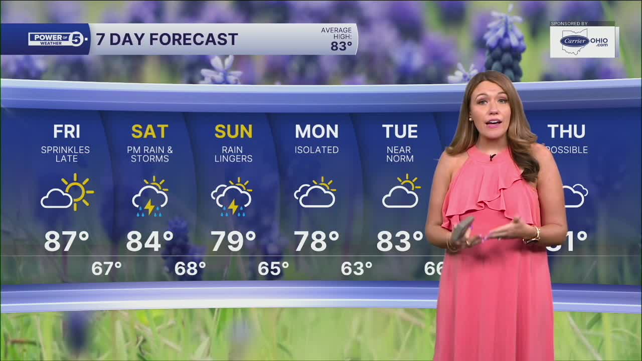
Summer warmth starts to build back in by Friday and the weekend. Highs will likely be in the mid and upper 80s Friday, and humidity will start to climb as well. More clouds also move in by Friday afternoon, starting in the west. A stray sprinkle is possible late Friday, but it's more likely to see rain and storms this weekend.
Rain chances will increase throughout Saturday afternoon and continue into Sunday. The best chance for rain, with the heaviest rain, will be Saturday night into Sunday morning. Exact ETA is still a little bit up in the air, but if you have evening plans on Saturday, be aware rain will be en route.
Latest data suggests the rain could linger a bit longer than we would like on Sunday, with even a couple of showers lingering on Monday. The rain is being brought to you by a cold front, so temperatures will dip a bit on Sunday and Monday. The cool down doesn't last long. In fact, it looks like August will be starting with above-average temperatures.
POWER OF 5 REGIONS: Five regions. Five forecasts closer to home
- CLE METRO REGION: (Cuyahoga County)| No worries overnight. Warmest for Cleveland, Euclid and Westlake with temperatures in the mid-60s; cooler temps overnight for Solon and Beachwood in the upper 50s. Warming up on Friday into the mid 80s with more clouds and humidity.
- AKRON-CANTON REGION: (Summit, Stark and Portage Counties) | Lows in the upper 50s with clear skies, although some patchy fog will be possible overnight with much calmer winds. Highs flirting with the 90s on Friday before rain returns this weekend. Stay cool at the Summit County Fair!
- SNOWBELT REGION: (Lake, Geauga and Ashtabula) | Calm and cool tonight. Not as much of a temperature spread overnight, but if you live farther inland, low 60s and upper 50s are expected with patchy areas of fog. Warming up nicely for the 4th day of the Lake County fair with increasing clouds.
- WEST REGION: (Lorain, Medina, Erie, Huron, Richland and Ashland Counties) | Since the wind is coming from off the lake one last time tonight, it will help keep nighttime temps warmer near the lakefront. The temperature drops nearly 10 degrees away from the lake breeze south of the turnpike. Clouds will increase in this region first on Friday. Same thing with the rain on Saturday. You may even catch a quick sprinkle Friday night/early Saturday.
- SOUTH REGION: (Wayne, Holmes, Tuscarawas and Carroll Counties) | Chilly tonight with lows in the 50s and clear skies. Some patchy fog possible. Temperatures climb into the upper 80s on Friday. It will be more humid too! Staying dry all day. Keep in mind that rain returns this weekend!
DAILY FORECAST:
Tonight: Wonderful night. Cooler inland. Less windy.| Lows: 64º
Friday: Clouds increase. Warmer & more humid. | High: 87º
Saturday: More clouds. T'storm chances late. | High: 83º
Sunday: Scattered t'storms. Humid. | High: 79°
Monday: Shower possible. Mostly cloudy. | High: 83º
Tuesday: Touch warmer. T'storm chance. | High: 85º
Want the latest Power of 5 weather team updates wherever you go? Download the News 5 App free now: Apple|Android
Click here to view our interactive radar.
Follow the News 5 Weather Team:
Trent Magill: Facebook & Twitter
Katie McGraw: Facebook & Twitter
Phil Sakal: Facebook & Twitter
Allan Nosoff: Facebook & Twitter
