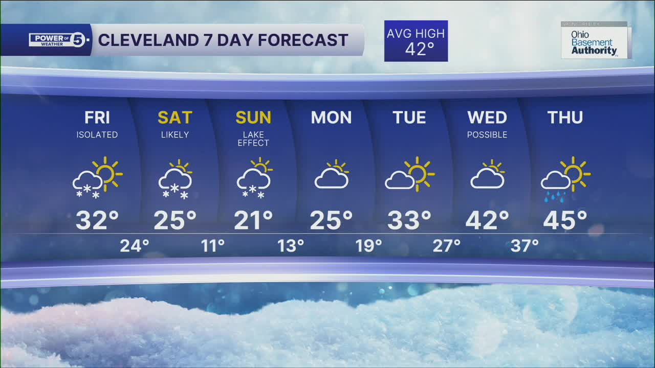


CLEVELAND — One of two clippers will begin to move into the Ohio Valley on Friday. Our shot at snow on Friday is very limited. The first clipper passes south of most of us on Friday morning. The best chance to see any snow from this clipper will be south of Rt. 30, towards Dover/New Philly. Temperatures will be cold once again, but many areas will bump up closer to freezing to round out the work week.
The temperatures will be much colder for the weekend, along with more snow.
More widespread snow will be possible on Saturday, with highs in the 20s. And that's followed by more frigid air for the start of next week. That colder air will ramp up the lake effect snow machine on Sunday, with more accumulations in the primary and secondary snowbelts.
If you're looking for a thaw... be patient. It's finally showing up on our more reliable models. We're building toward a nice thaw toward the end of NEXT week.
DAILY FORECAST:
Friday: Cold with a few snow showers, especially south of Akron, in the morning. | High: 32º
Saturday: Cold with some snow likely. | High: 25º
Sunday: Lake effect snow. Colder. | High: 21º
Monday: Drying out. Still cold. | High: 25º
Tuesday: More sunshine and warming. | High: 33º
Wednesday: Shower possible. Warmer. | High: 42º
Thursday: Rain showers. Warm. | High: 45º
Want the latest Power of 5 weather team updates wherever you go? Download the News 5 App free now: Apple|Android
Click here to view our interactive radar.
Follow the News 5 Weather Team:
Trent Magill: Facebook & Twitter
Katie McGraw: Facebook & Twitter
Phil Sakal: Facebook & Twitter
Allan Nosoff: Facebook & Twitter
