


CLEVELAND — Summer-like temperatures will continue for another day across Northeast Ohio to begin the new work week. Highs will top off in the low to mid-80s on Monday, but more clouds are expected to return to the region, and the area will remain mostly dry. A cold front will begin to make an appearance late Monday into Tuesday.
Our stretch of dry days will finally come to an end on Tuesday, and so will the late-season heat. A stray pop-up shower can't be ruled out on Monday evening, mainly south and west of Akron, but widespread showers are expected to wait until Tuesday during the morning commute. Plan on scattered rain on Tuesday with some isolated strong-to-severe thunderstorms. Rain and or storms could produce heavy rain at times, with some minor flooding possible. Behind the front on Wednesday, expect drier and much cooler air to round out the workweek. We actually look to fall BELOW average by then! Highs will struggle to reach the low 60s on Wednesday afternoon and fall to near 40 degrees Thursday morning, with 30s inland. Some patchy frost will be possible across our inland communities for the first time this season!
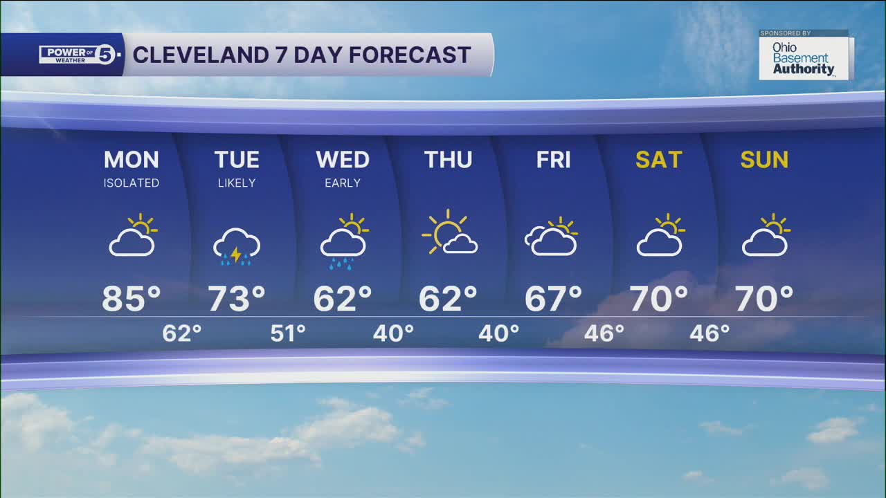
DAILY FORECAST:
Monday: More clouds but staying very warm. | High: 85º
Tuesday: Scattered rain showers and t-storms as cooler air rushes in. | High: 73º
Wednesday: Early shower, then sunshine, much cooler. | High: 62º
Thursday: Mostly sunny and seasonably cool. | High: 62º
Friday: More clouds. Chance of a stray shower.| High: 67º
Saturday: Partly sunny. Seasonable. | High: 70º
Want the latest Power of 5 weather team updates wherever you go? Download the News 5 App free now: Apple|Android
Click here to view our interactive radar.
Follow the News 5 Weather Team:
Trent Magill: Facebook & Twitter
Katie McGraw: Facebook & Twitter
Phil Sakal: Facebook & Twitter
Allan Nosoff: Facebook & Twitter
