



CLEVELAND — Plan for a chilly night and morning as temperatures fall into the 40s across much of NEO. A few spots away from the lake could dip into the upper 30s. Otherwise, it will be quiet and calm.
After a frigid start, the rest of Friday's forecast is pretty fabulous. We'll start with more sun before high clouds increase throughout the day. Temperatures climb into the lower 70s and conditions remain great for football games, tailgates, and any Friday evening plans.
The warming trend continues Saturday as temps jump into the upper 70s and even low 80s. It will feel like summer! Clouds will become more common, but most of the day stays dry.
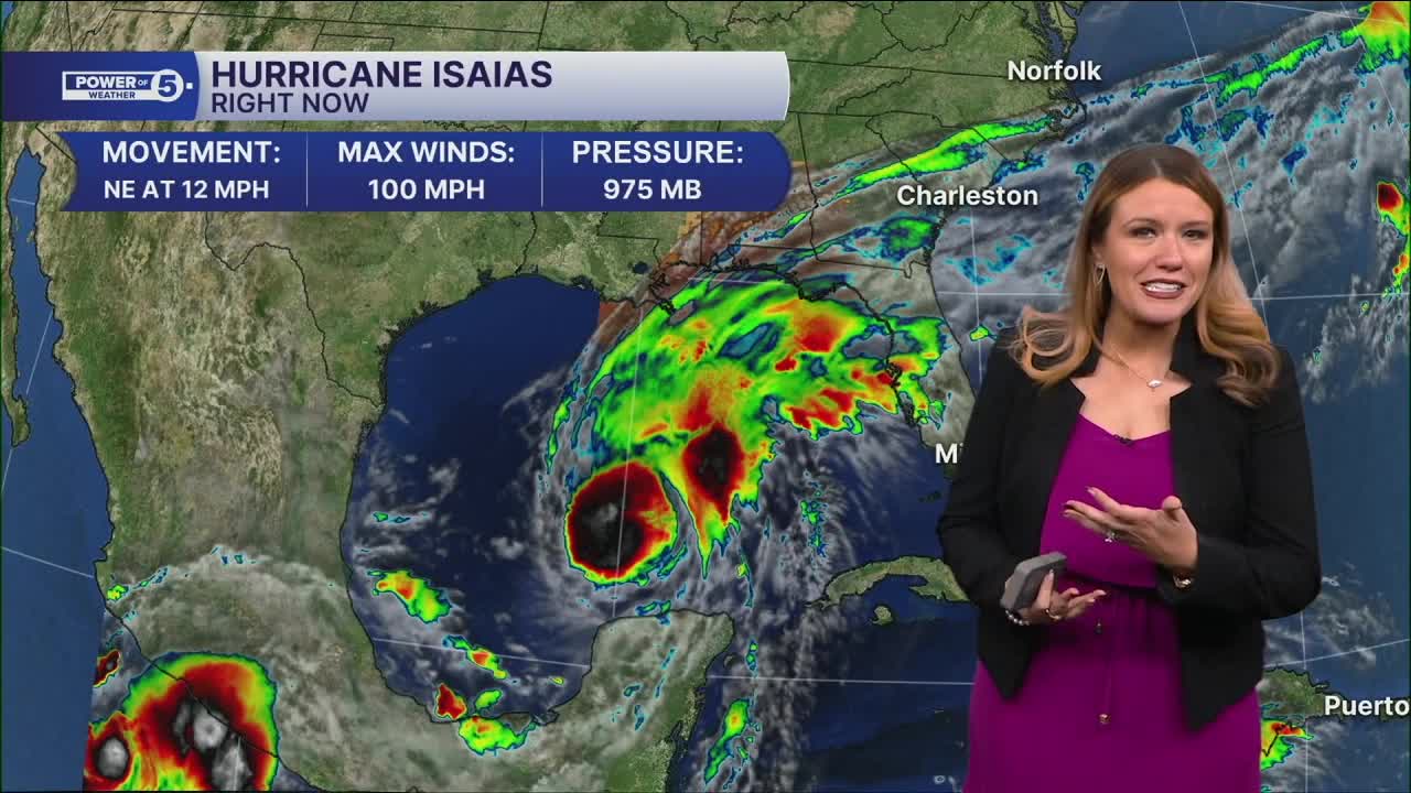
The bigger change arrives Sunday as the remnants of Isaías move into the Ohio Valley. Expect a steady, soaking rain with many communities picking up between a half inch and an inch of rainfall. It won't be an all-day downpour, but periods of rain are likely through much of Sunday, and outdoor plans may need a backup option.
Power of 5 Regions Highlight: South Region
All of NEO looks dry with increasing clouds and temperatures over the next two days. Rain returns late Saturday into early Sunday, and it looks like it will start in the South Region. It also could be the region that picks up the heaviest rainfall throughout the day on Sunday, because the South Region will be closer to the remnant low pressure of Hurricane Isaias. While we are due for some rain, we do not want too much rain too fast. We will monitor the flood threat over the next few days and keep you posted!
5-Day Forecast:
Thursday: Sun, clouds, comfy | High: 69º
Friday: Partly sunny. Mild. | High: 71º
Saturday: Super warm! Still dry. | High: 78º
Sunday: Soaked from the remnants of Isaias. | High: 65º
Monday: Trying to dry out.| High: 69º
Learn the lingo: The Power of 5 Weather Team wants to get you your forecast closer to home. We have broken NEO into 5 separate and distinct regions. Find your region to get your hyper-local forecast!
- Cleveland Metro Region: Cuyahoga County. This region includes cities such as Cleveland, Parma, Westlake, Berea, Strongsville, Independence, Solon, Beachwood, and Euclid.
- Snowbelt Region: Lake, Geauga, and Ashtabula Counties. This includes cities such as Mentor, Geneva, Ashtabula, Bainbridge, Chardon, Burton, and Orwell.
- Akron-Canton Region: Summit, Stark, and Portage Counties. This region includes cities such as Akron, Canton, Hudson, Ravenna, Mantua, Alliance, and Canal Fulton.
- West Region: Lorain, Medina, Erie, Huron, Richland, and Ashland Counties. This region includes cities such as Lorain, Wellington, Medina, Lodi, Ashland, Mansfield, Willard, and Sandusky.
- South Region: Wayne, Holmes, Tuscarawas, Carroll Counties. This region includes Wooster, Millersburg, New Philadelphia, Strasburg, Mineral City, Carrollton, and Newcomerstown
You can send us photos and short videos by filling out the form below:
Want the latest Power of 5 weather team updates wherever you go? Download the News 5 App free now: Apple|Android
Click here to view our interactive radar.
Follow the News 5 Weather Team:
Trent Magill: Facebook & Twitter
Katie McGraw: Facebook & Twitter
Phil Sakal: Facebook & Twitter
Allan Nosoff: Facebook & Twitter
