



CLEVELAND —
Wind, falling temps and lake effect showers kick off the weekend
Friday gets colder as it goes.
NW winds will gust to around 25 mph while we dodge off-and-on showers. Temps will also head the wrong direction, dropping into the 40s this afternoon. Keep the jacket handy, and don’t count on a dry walk or outdoor chore window lasting all that long.
Wind picks up tonight
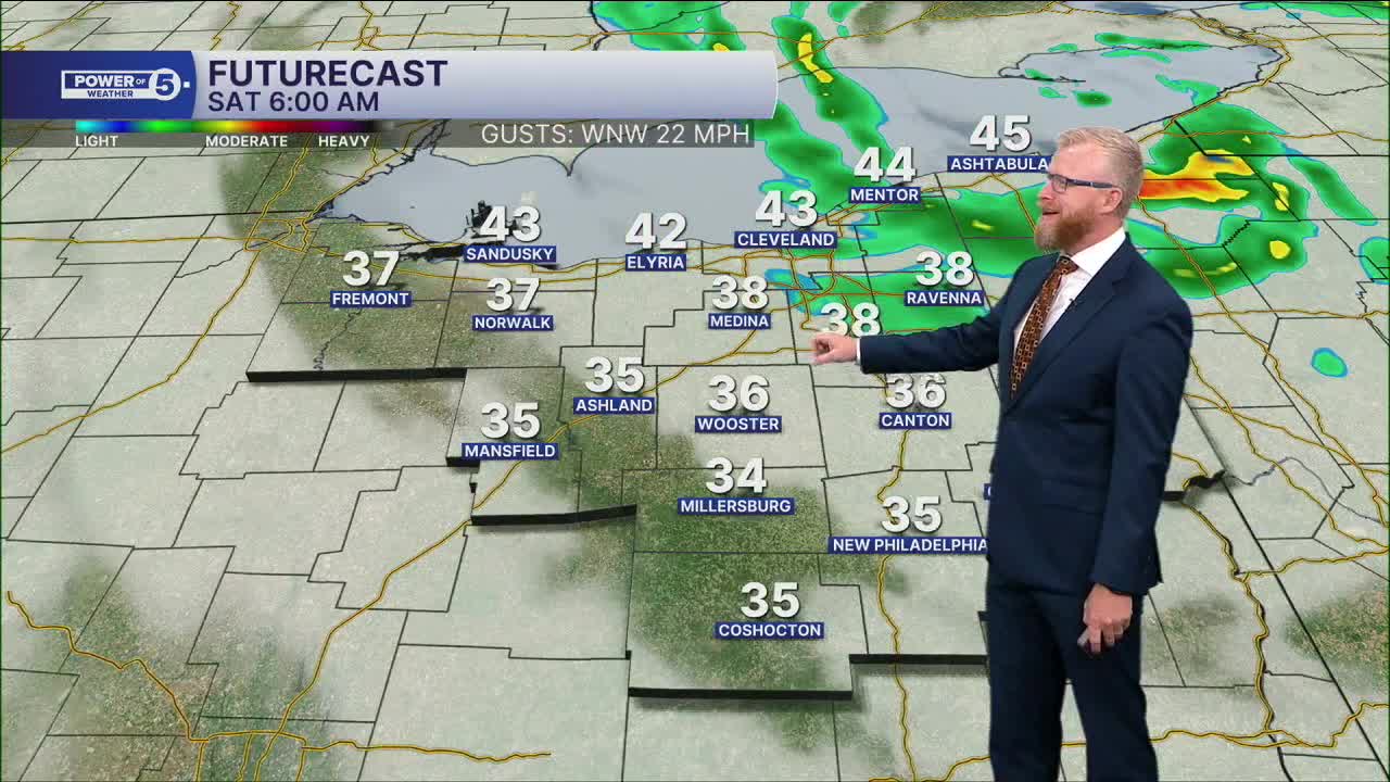
The wind gets even stronger overnight with gusts around 35 mph. A few more showers will be around too.
Most of us fall into the lower 40s, but the drier South and West regions could sneak into the 30s by early Saturday. That’s definitely heavier-jacket weather if you’re heading out first thing.
Region Highlight: Snowbelt Region- A raw Saturday near Lake Erie
Saturday isn’t a washout everywhere, but it won’t exactly be a great outdoor day either.
Lake effect rain showers will keep popping up, especially through the Cleveland Metro and Snowbelt regions. Other spots will find longer dry breaks.
Rain or shine, highs only make it into the 40s for everyone, and the breeze will make it feel even colder. If you were hoping to tackle the last of the leaves, Saturday probably isn’t your best raking day, especially closer to the lake.
A little better by Sunday
The weekend finishes on a better note. 50s return Sunday and stick around into Monday, finally taking some of the November chill out of the air.
What to grab: A warmer jacket through Saturday, an umbrella or rain jacket if you’re around Cleveland or the Snowbelt, and maybe some patience if those leaves keep blowing right back across the yard.
5-Day Forecast:
Friday: Chilly with a few rain showers. | High: 50°
Saturday: A few rain showers, still chilly. | High: 50º
Sunday: Looking drier, seasonable. | High: 54º
Monday: Partly sunny and seasonable. | High: 55º
Tuesday: More sun, more warmth. | High: 59º
Learn the lingo: The Power of 5 Weather Team wants to get you your forecast closer to home. We have broken NEO into 5 separate and distinct regions. Find your region to get your hyper-local forecast!
- Cleveland Metro Region: Cuyahoga County. This region includes cities such as Cleveland, Parma, Westlake, Berea, Strongsville, Independence, Solon, Beachwood, and Euclid.
- Snowbelt Region: Lake, Geauga, and Ashtabula Counties. This includes cities such as Mentor, Geneva, Ashtabula, Bainbridge, Chardon, Burton, and Orwell.
- Akron-Canton Region: Summit, Stark, and Portage Counties. This region includes cities such as Akron, Canton, Hudson, Ravenna, Mantua, Alliance, and Canal Fulton.
- West Region: Lorain, Medina, Erie, Huron, Richland, and Ashland Counties. This region includes cities such as Lorain, Wellington, Medina, Lodi, Ashland, Mansfield, Willard, and Sandusky.
- South Region: Wayne, Holmes, Tuscarawas, Carroll Counties. This region includes Wooster, Millersburg, New Philadelphia, Strasburg, Mineral City, Carrollton, and Newcomerstown
You can send us photos and short videos by filling out the form below:
Want the latest Power of 5 weather team updates wherever you go? Download the News 5 App free now: Apple|Android
Click here to view our interactive radar.
Follow the News 5 Weather Team:
Trent Magill: Facebook & Twitter
Katie McGraw: Facebook & Twitter
Phil Sakal: Facebook & Twitter
Allan Nosoff: Facebook & Twitter
