



CLEVELAND —
Stormy Wednesday morning, much colder
The summer-like weather is gone. I hope you had a chance to enjoy the record-shattering warmth (records listed below). Plan for a very different day on Wednesday.
Scattered rain and storms are moving through this morning, starting first in our northern and western communities and moving south and east. These storms have been producing really loud thunder with what is known as 'positive' lightning strikes. Give yourself some extra time for the morning commute. Heavy downpours could briefly make roads hard to see. Kids heading to the bus stop or school: keep rain gear handy and have a way to get indoors quickly if you hear thunder.
Temps won’t move much Wednesday, holding in the 60s through the day, which will be about 20 degrees cooler than Tuesday! The best chance for rain on Wednesday is the first half of the day. Additional showers are more likely in central and southern Ohio, so our south region could see a few more raindrops later in the day.
Another round of rain and storms moves in Thursday evening and continues into Friday. These *could* impact the Guardians Game.
ICYMI: several records were broken on Tuesday.
- Cleveland: Smashed the old record of 82º, set back in 1969, with a high temperature of 86º
- Akron/Canton: Broke the old record of 82º, set back in 1969, with a high temperature of 83º
- Mansfield: Broke the old record of 84º, set back in 1969, with a high temperature of 85º
Power of 5 Regions: CLE Metro Region
Rain and storms will continue through the morning, then all eyes turn to the ALCS with Game 3 back at home. Storms could contain lightning and damaging wind gusts as they approach the game's end. The Power of 5 Weather team will be keeping a very close eye on the forecast as we get a better idea regarding the timeline. Stay tuned!
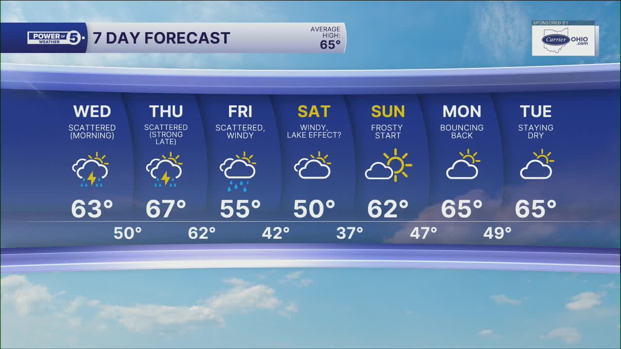
5-Day Forecast:
Today: Scattered morning storms. Breezy & much cooler. | High: 65º
Thursday: Storms likely after sunset, potential impacts to ALCS Game 3. | High: 67º
Friday: Scattered showers. Windy. Cooler again. | High: 55º
Saturday: Lake effect showers. Cooler and breezy. | High: 50º
Sunday: Widespread frost. Mostly sunny and cool. | High: 55º
Learn the lingo: The Power of 5 Weather Team wants to get you your forecast closer to home. We have broken NEO into 5 separate and distinct regions. Find your region to get your hyper-local forecast!
- Cleveland Metro Region: Cuyahoga County. This region includes cities such as Cleveland, Parma, Westlake, Berea, Strongsville, Independence, Solon, Beachwood, and Euclid.
- Snowbelt Region: Lake, Geauga, and Ashtabula Counties. This includes cities such as Mentor, Geneva, Ashtabula, Bainbridge, Chardon, Burton, and Orwell.
- Akron-Canton Region: Summit, Stark, and Portage Counties. This region includes cities such as Akron, Canton, Hudson, Ravenna, Mantua, Alliance, and Canal Fulton.
- West Region: Lorain, Medina, Erie, Huron, Richland, and Ashland Counties. This region includes cities such as Lorain, Wellington, Medina, Lodi, Ashland, Mansfield, Willard, and Sandusky.
- South Region: Wayne, Holmes, Tuscarawas, Carroll Counties. This region includes Wooster, Millersburg, New Philadelphia, Strasburg, Mineral City, Carrollton, and Newcomerstown
You can send us photos and short videos by filling out the form below:
Want the latest Power of 5 weather team updates wherever you go? Download the News 5 App free now: Apple|Android
Click here to view our interactive radar.
Follow the News 5 Weather Team:
Trent Magill: Facebook & Twitter
Katie McGraw: Facebook & Twitter
Phil Sakal: Facebook & Twitter
Allan Nosoff: Facebook & Twitter
