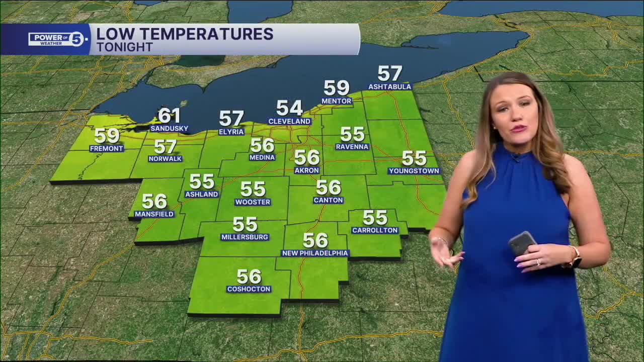


CLEVELAND — Feast or famine! That was the story on Wednesday with soaked southern communities and bone-dry weather for the northern half of NEO. For the rest of this evening, showers will end, with decreasing cloud cover. It will be cooler than Tuesday night, with lows in the 50s for much of NEO.
Speaking of cool, a cold front slid through the area on Wednesday. This front changed the wind direction (from the south to the north), and it will get a bit breezier by Thursday with gusts around 20 mph. The front will keep it cooler on Thursday. Plan for the 60s to low 70s during Thursday afternoon, but there will be plenty of sunshine.
It will get slightly milder on Friday with temperatures in the low 70s, but the trend for the next several days is below average temperatures. In fact, another dry cold front will move through the region between Friday and Saturday. While any rain is unlikely, it will cause the temps to dip into the low 60s for Saturday! Reminder that the average high temperature for the end of May is in the mid 70s.
Cooler than normal, but it will also be drier than normal through early June!
DAILY FORECAST:
Wednesday Night: Drying & clearing out. Cooler.| Low: 54º
Thursday: Cooler & brighter & breezier.| High: 67º
Friday: Tons of sun. Comfortable.| High: 71º
Saturday: More clouds. Unseasonably cool.| High: 62º
Sunday: Sun & clouds. Bit milder.| High: 67º
Want the latest Power of 5 weather team updates wherever you go? Download the News 5 App free now: Apple|Android
Click here to view our interactive radar.
Follow the News 5 Weather Team:
Trent Magill: Facebook & Twitter
Katie McGraw: Facebook & Twitter
Phil Sakal: Facebook & Twitter
Allan Nosoff: Facebook & Twitter
