


CLEVELAND — Here comes the rain!
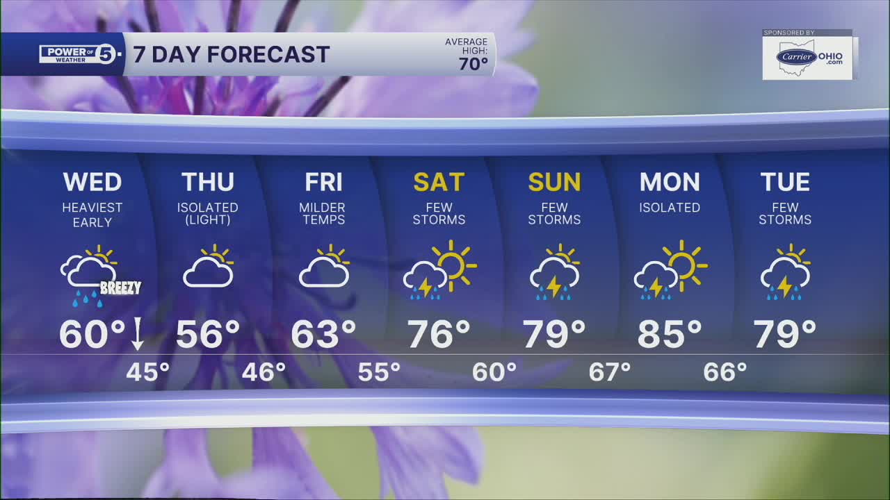
Rain chances will slowly increase this evening and become likely after midnight. Plan for widespread and heavier rain from midnight until about sunrise. Get out the door a bit early on Wednesday to avoid any slowdowns. Visibility, wet roads, and even wind could be a concern for the morning commute. Gusts of 30 to 40 mph are possible during the wee hours of Wednesday morning into the mid-morning.
Widespread showers will exit by 7 to 9 am, but we will be watching for redevelopment along the front by the late morning and early afternoon in our southeasternmost communities. There is a much better chance in PA and SE Ohio for this to happen.
Temperatures will remain steady overnight, but as a cold front swings through tomorrow, temperatures will drop from near 60º into the lower 50s to upper 40s by the PM Drive. It will remain below average on Thursday with a few light showers, especially in the eastern half of the viewing area. After that, we focus on a BIG warm-up for the weekend and early next week! Hello, summer-like weather!
DAILY FORECAST:
Tonight: Rain likely. Heavy overnight. Breezy winds. | Low: 60º
Wednesday: Rain likely, especially early. Falling temperatures | High: 58º (midday then dropping)
Thursday: Mostly cloudy, a few showers possible. | High: 54º
Friday: Partly cloudy. Seasonable. | High: 63º
Saturday: Warm & breezy with a few storms. | High: 76º
Sunday: Storms possible, still warm. | High: 79º
Monday: Storms possible, even warmer. | High: 82º
Want the latest Power of 5 weather team updates wherever you go? Download the News 5 App free now: Apple|Android
Click here to view our interactive radar.
Follow the News 5 Weather Team:
Trent Magill: Facebook & Twitter
Katie McGraw: Facebook & Twitter
Phil Sakal: Facebook & Twitter
Allan Nosoff: Facebook & Twitter
