


CLEVELAND — More cold, wind and snow across NEO!
- LAKE EFFECT SNOW WARNING: Issued for Cuyahoga, Lake, Geauga, and Ashtabula Counties through 7 p.m. Friday.
- WINTER WEATHER ADVISORY: Issued for Lorain, Summit and Shoreline Ashtabula Counties through 1 p.m. Friday.
Plan on heavy snow in squalls east of Cleveland and into the primary snowbelt on Thanksgiving and then eventually into the secondary through Black Friday. Some communities could pick up over 12 inches of snow. This will impact travel over the holiday. Not only is snow expected, but it will still be blustery on Friday. This could cause blowing and drifting snow, plus brutal wind chills in the teens.
Lake effect snow will gradually taper off Friday afternoon, but we may get in on another round of rain and snow to finish out the Holiday Weekend, especially late Saturday into Sunday. More on that round as we get into the end of the week.
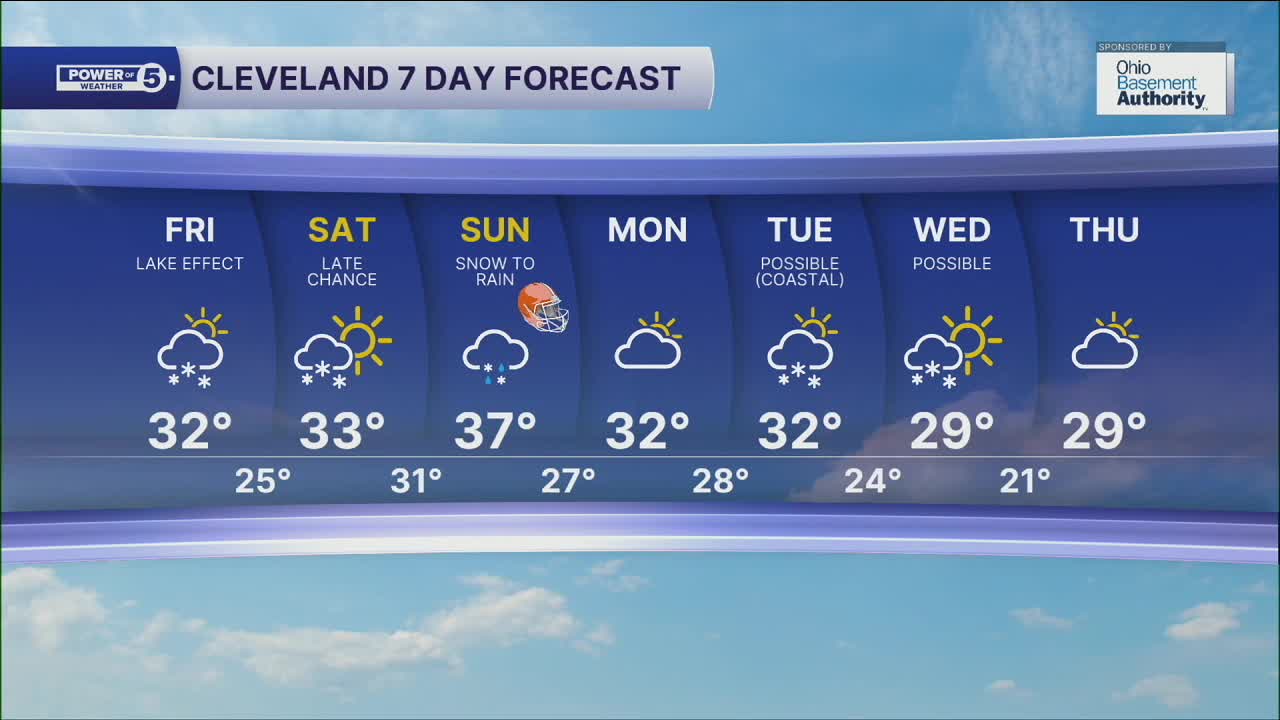
DAILY FORECAST:
Friday: Less windy but still cold & snowy, especially Cleveland metro, points east and southeast. | High: 32º
Saturday: Snow showers possible late. Cold. | High: 35º
Sunday: Snow mixing to rain. | High: 39º
Monday: Cloudy & Cold. | High: 32º
Want the latest Power of 5 weather team updates wherever you go? Download the News 5 App free now: Apple|Android
Click here to view our interactive radar.
Follow the News 5 Weather Team:
Trent Magill: Facebook & Twitter
Katie McGraw: Facebook & Twitter
Phil Sakal: Facebook & Twitter
Allan Nosoff: Facebook & Twitter
