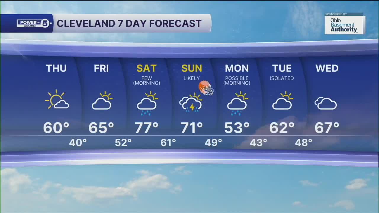


CLEVELAND — May need to give yourself a few extra minutes to get to your destination on Thursday morning, as patchy frost will be possible, especially in our inland communities. After the frosty start on Thursday, plenty of sunshine will warm us back to around 60 by the end of Thursday afternoon.
Temperatures will bump back up to round out the work week, as highs will top off in the mid to upper 60s on Friday, under partly sunny skies.
A warm front will bring the chance for a few showers early on Saturday. Temperatures will be even warmer to begin the weekend, with highs in the mid 70s to upper on Saturday behind the front, along with windy conditions. A cold front will start to move in late Saturday evening through the day on Sunday.
This front will bring much more significant rain chances to the region, along with storm chances and more wind. Most of the rain looks to happen after sunset on Saturday, so the first half of the weekend seems to be the better day for outdoor activities.
The cold front will move through the region by mid to late afternoon on Sunday, so rain and even storms could impact the Browns game on Sunday afternoon. Wind gusts of 40 to 50 mph will be possible as the front moves through. Cooler air will filter in for the start of the new work week behind the front, as highs drop into the mid 50s, along with a few lingering rain chances on Monday.
DAILY FORECAST:
Thursday: Sun returns. Temps struggle. | High: 60º
Friday: Partly sunny. Not as cool. | High: 65º
Saturday: Few early showers. T'storms possible late. Warmer. | High: 77º
Sunday: Rain likely. Storms possible. Windy. | High: 71º
Monday: Early shower chance. Cooler again. | High: 53º
Tuesday: Isolated shower chance. Seasonable. | High: 62º
Wednesday: Shower chance. Cooler again. | High: 62º
Want the latest Power of 5 weather team updates wherever you go? Download the News 5 App free now: Apple|Android
Click here to view our interactive radar.
Follow the News 5 Weather Team:
Trent Magill: Facebook & Twitter
Katie McGraw: Facebook & Twitter
Phil Sakal: Facebook & Twitter
Allan Nosoff: Facebook & Twitter
