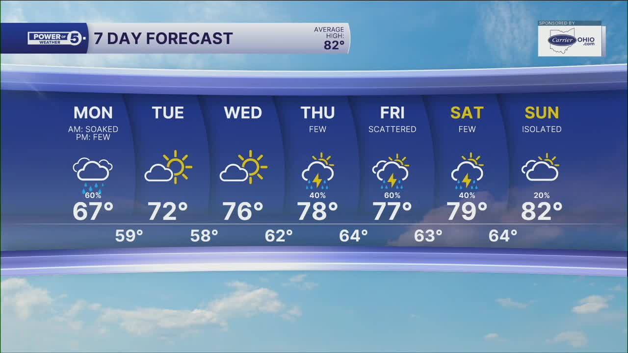


CLEVELAND — SOAKED this morning. That won't be the trend all day, though. We're drying out quickly, and most of us stay dry the rest of the day. Most of us.
I'm still tracking a few t-storms this afternoon. Those could be strong. But the best shot for them is south of Rt. 30. That's where afternoon temps could touch the 70s. North of Rt. 30 will hod in the 60s all day.
We're staying on the "cooler than normal" side through midweek. Low humidity, bright sun, great temps... Great for June!
Late week, we bring the heat, humidity, and thunderstorms back. We're closer to 80º with several rounds of thunder in the forecast.
DAILY FORECAST:
Monday: Cloudy & cool with a few PM storms south. High: 67º
Tuesday: Mostly sunny & comfortable. High: 72º
Wednesday: Bright & still comfortable. High: 76º
Thursday: Warmer with a few storms. High: 78º
Friday: Scattered storms. High: 77º
Saturday: A few storms. High: 79º
Want the latest Power of 5 weather team updates wherever you go? Download the News 5 App free now: Apple|Android
Click here to view our interactive radar.
Follow the News 5 Weather Team:
Trent Magill: Facebook & Twitter
Katie McGraw: Facebook & Twitter
Phil Sakal: Facebook & Twitter
Allan Nosoff: Facebook & Twitter
