


CLEVELAND — As a cold front moved through NEO, Thursday started with some downpours, but we are now finishing the day with clearing skies and much cooler temperatures. It was 82 degrees on Wednesday, but temperatures were only in the 60s this afternoon. With clear skies, we will keep dropping into the upper 40s to low 50s tonight!
A sunny and cold start on Friday quickly gives way to a warm and windy midday. A warm front surges in from the southwest and temperatures rise from 50 to near-80 by 3 p.m., which is a 30-degree turnaround in just several hours.
However, do not get used to the warm-up. The warm front is quickly followed by another cold front, which will bring another round of a few thundershowers and isolated downpours on Friday evening - especially in our southern and eastern communities. Between the warm and cold fronts, a strong southerly wind will bring in some gusts over 30 mph and could even be 40 mph at times.
Showers will linger, especially inland, through Friday night and early Saturday. Since this is a cold front, it will be colder again this weekend, stuck in the 50s and 60s before another warm up next week.
DAILY FORECAST:
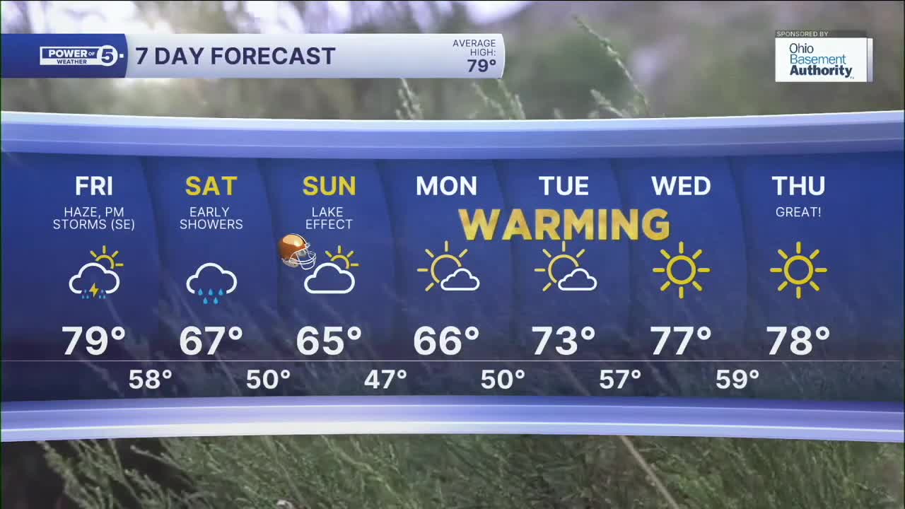
Tonight: Clearing sky. Much cooler. | Low: 52º
Friday: Windy & warmer with a few late-day storms. | High: 79º
Saturday: Cooler again. A few showers, especially early. | High: 68º
Sunday: Cool & breezy with a light lake effect shower possible. | High: 66º
Monday: Still cool but brighter. | High: 66º
Want the latest Power of 5 weather team updates wherever you go? Download the News 5 App free now: Apple|Android
Click here to view our interactive radar.
Follow the News 5 Weather Team:
Trent Magill: Facebook & Twitter
Katie McGraw: Facebook & Twitter
Phil Sakal: Facebook & Twitter
Allan Nosoff: Facebook & Twitter
