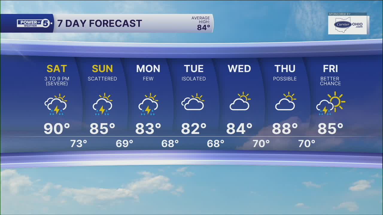


CLEVELAND — The heat wave is coming to an end after either four or five days. It will depend on today's high, which is expected to be on either side of 90 degrees. The timing of the storms will dictate whether or not it officially reaches 90 degrees.
Yesterday's storms were more widespread and packed a punch with up to 60 mph gusts and ponding on roads. That does take away some storm energy for today, and the area for severe weather also slides S&E. It will still be steamy on the fourth, but not AS hot as the last few days. Temps will be around 90 degrees with heat indices in the upper 90s to low triple digits. A heat advisory is in effect for Saturday because that kind of heat is still dangerous.
The Fourth of July *fourth*cast brings thunderstorms mainly after 3 p.m. for areas S&E of Cleveland. For our friends on the west side in areas like Cedar Point & Sandusky, it may be dry all day. Again, the best chance for severe storms on Independence Day will south and east of Akron, with a tier 2 of 5 risk starting in Canton points south.
Additional on-and-off storms are expected on Sunday as well. The increase in storm chances will decrease our temperatures by next week. It will still be warm and summery, but highs in the low to mid 80s are expected.
DAILY FORECAST:
4th of July: Scattered storms, could be severe. Still hot & humid. | High: 90º, feels like 95-100º
Sunday: Scattered storms. Could be strong | High: 85º
Monday: A few more storms. Not as hot. | High: 83º
Tuesday: Isolated thunder but still more seasonable. | High: 82º
Want the latest Power of 5 weather team updates wherever you go? Download the News 5 App free now: Apple|Android
Click here to view our interactive radar.
Follow the News 5 Weather Team:
Trent Magill: Facebook & Twitter
Katie McGraw: Facebook & Twitter
Phil Sakal: Facebook & Twitter
Allan Nosoff: Facebook & Twitter
