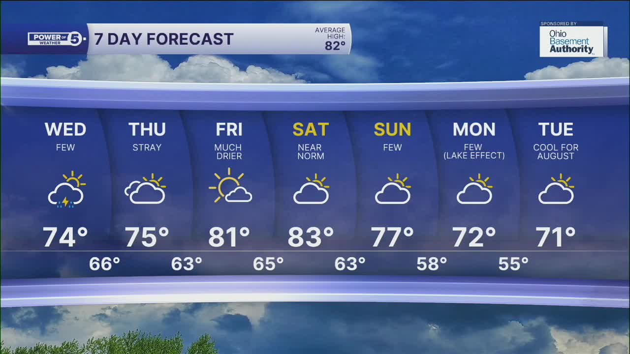


CLEVELAND — As a cold front rolled through NEO on Tuesday, it brought scattered storms on Tuesday evening. Thankfully, there were no damaging storms, but they were still impactful with heavy rain and lightning. Storms are fading overnight, but we can't drop the rain chance on Wednesday.
The cold front will live up to its name. It will be mild overnight with lows around 70 degrees, but then temperatures will struggle for the rest of the day. Afternoon temperatures will likely get stuck in the low to mid 70s! It will also be a pretty gloomy day with more clouds than sun as well as lingering t-showers. The coverage and intensity will be lower than on Tuesday. Winds will also be increasing throughout the day on Wednesday. It will be breezy by Wednesday night and into Thursday. With the stronger winds, the conditions on the lake will become dangerous again.
It looks drier by Thursday, but temperatures will remain in the mid 70s. We will get a temp bump on Friday, though! Another front aims at our region this weekend. It does not look like a washout, but a few t-showers will be possible on Sunday as the front moves through NEO. This front will also usher in MUCH cooler air. We will get a taste of FALL by early next week.
News 5 Meteorologist Katie McGraw was live with storm updates Tuesday evening:
DAILY FORECAST:
Tuesday Night: Storms fade, stray showers. Mostly cloudy. Warm & muggy. | Low: 70º
Wednesday: Few t-showers, followed by late-day sun. | High: 77º
Thursday: Mostly sunny and pleasant. | High: 79º
Friday: Mostly sunny and warmer. | High: 81º
Saturday: Mostly dry. Touch warmer. | High: 83º
Want the latest Power of 5 weather team updates wherever you go? Download the News 5 App free now: Apple|Android
Click here to view our interactive radar.
Follow the News 5 Weather Team:
Trent Magill: Facebook & Twitter
Katie McGraw: Facebook & Twitter
Phil Sakal: Facebook & Twitter
Allan Nosoff: Facebook & Twitter
