



CLEVELAND — It was the coldest start since mid-May for many across Northeast Ohio, with widespread 40s for low temperatures Friday morning. A few spots in our south region and snowbelt region in the higher elevations even dropped into the 30s for the first time since Spring!
Tonight will be chilly again, but not AS cold as last night. A few more clouds will be in the sky, and it will be a couple of degrees milder, with lows in the 50s along the lakeshore and mid-40s farther inland.
Power of 5 Regions Spotlight: Snowbelt Region
Sorry Katie! As much as I would've loved to keep the Cleveland! metro region as the highlight all weekend long, the forecast will be iffy on the east side because of the nor'easter off the Jersey Shore. Clouds return Sunday, and a few showers are expected to be nearby Sunday night into early Monday.
Fall feel for first weekend of Autumn:
The weekend forecast looks great. Highs will jump a couple of degrees and hold close to 70 both Saturday and Sunday with dry weather, breezy winds during the daytime hours, and chilly temperatures at night with calmer winds.
Browns Home Opener Forecast:
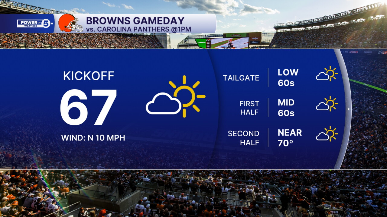
It doesn't get much better than this for late September football weather. Sunday's Browns home opener is shaping up to be gorgeous from start to finish. Tailgaters will enjoy cool morning temps and plenty of sunshine. By kickoff, readings will be comfortably near 67 with low humidity. We stay great through halftime and into the afternoon with no weather worries.
Looking Ahead:
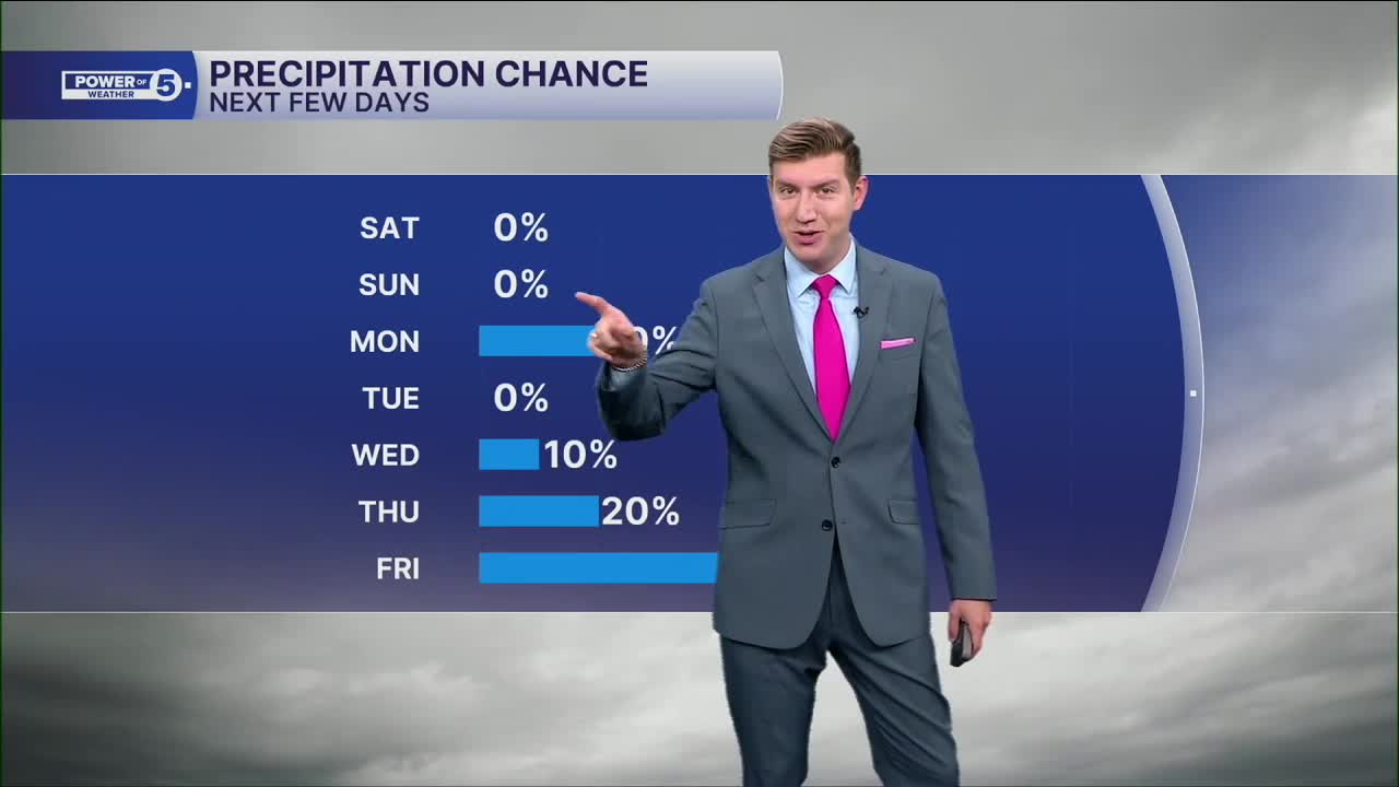
The dry stretch continues into early next week with seasonable temps and comfortable nights. The next meaningful chance for rain doesn't arrive until at least Wednesday of next week. Latest data continues to push the best rain chances later. The best chance for rain looks to arrive on Friday, but we will keep you posted in the coming days about timing of rain.
Enjoy the sunshine and the taste of fall while it lasts! It will be more like early September weather as the calendar turns to October on Thursday.
5-Day Forecast:
Saturday: More sun, a touch milder. | High: 69º
Sunday: Bright & comfy. | High: 71º
Monday: Mostly sunny. | High: 71º
Tuesday: Partly cloudy, warm. | High: 73º
Wednesday: Partly cloudy. Warm. | High: 75º
Learn the lingo: The Power of 5 Weather Team wants to get you your forecast closer to home. We have broken NEO into 5 separate and distinct regions. Find your region to get your hyper-local forecast!
- Cleveland Metro Region: Cuyahoga County. This region includes cities such as Cleveland, Parma, Westlake, Berea, Strongsville, Independence, Solon, Beachwood, and Euclid.
- Snowbelt Region: Lake, Geauga, and Ashtabula Counties. This includes cities such as Mentor, Geneva, Ashtabula, Bainbridge, Chardon, Burton, and Orwell.
- Akron-Canton Region: Summit, Stark, and Portage Counties. This region includes cities such as Akron, Canton, Hudson, Ravenna, Mantua, Alliance, and Canal Fulton.
- West Region: Lorain, Medina, Erie, Huron, Richland, and Ashland Counties. This region includes cities such as Lorain, Wellington, Medina, Lodi, Ashland, Mansfield, Willard, and Sandusky.
- South Region: Wayne, Holmes, Tuscarawas, Carroll Counties. This region includes Wooster, Millersburg, New Philadelphia, Strasburg, Mineral City, Carrollton, and Newcomerstown
You can send us photos and short videos by filling out the form below:
Want the latest Power of 5 weather team updates wherever you go? Download the News 5 App free now: Apple|Android
Click here to view our interactive radar.
Follow the News 5 Weather Team:
Trent Magill: Facebook & Twitter
Katie McGraw: Facebook & Twitter
Phil Sakal: Facebook & Twitter
Allan Nosoff: Facebook & Twitter
