


CLEVELAND — After widespread wind damage from severe storms Sunday, it will be a pleasant weather day for any clean-up Monday. Below-average temperatures are here, with highs falling into the upper 60s to near 70 on Monday. Highs will slowly warm to more seasonable levels by the end of the week.
Rain chances will increase once again by Tuesday through the end of the week, with warmer and more humid air moving back into the region.
The next increased threat for stronger storms returns late Wednesday into Thursday.
DAILY FORECAST:
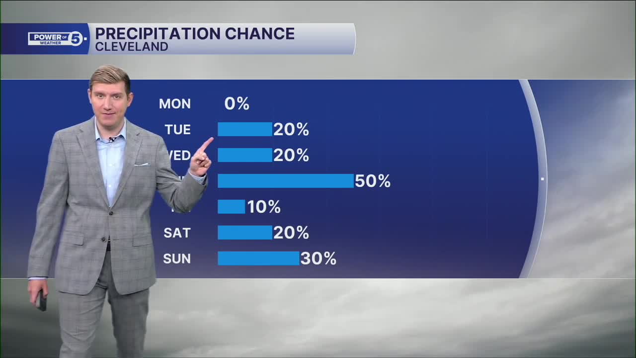
Monday: Partly cloudy. Dry and cooler.| High: 70º
Tuesday: Partly cloudy. Isolated evening downpours.| High: 75º
Wednesday: Partly cloudy. Scattered evening storms; could be severe.| High: 77º
Thursday: Scattered storms and flooding downpours possible.| High: 81º
Juneteenth: Partly sunny. Stray shower possible.| High: 79º
Saturday: Partly sunny. Seasonable.| High: 83º
Want the latest Power of 5 weather team updates wherever you go? Download the News 5 App free now: Apple|Android
Click here to view our interactive radar.
Follow the News 5 Weather Team:
Trent Magill: Facebook & Twitter
Katie McGraw: Facebook & Twitter
Phil Sakal: Facebook & Twitter
Allan Nosoff: Facebook & Twitter
