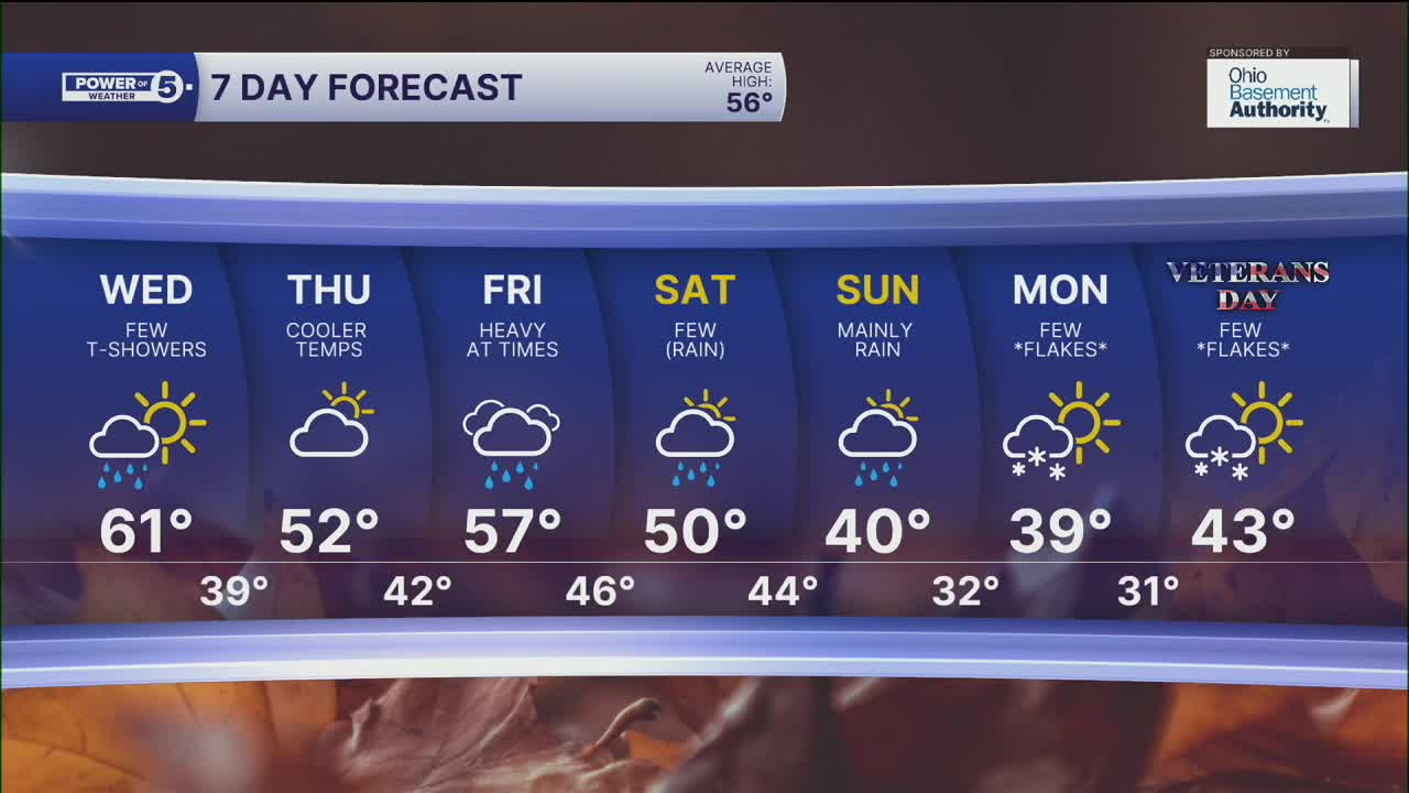


CLEVELAND — It is a cold front parade this week! One after another after another. One already moved through on Monday, and the next cold front is expected tomorrow. Plan on a few afternoon and evening t-showers on Wednesday.
This front will also kick up our winds again! For most of NEO, wind gusts will be over 35 mph, but closer to the lake shore, wind gusts over 45 mph will be possible. A wind advisory has been issued for Cuyahoga, Lake, Lorain, and northern Ashtabula Counties from 1 pm to 10 pm Wednesday. An isolated strong storm could bring 50-60 mph winds to the surface as well.
Thursday will be dry and cool, but this week's third cold front and best opportunity for rain will be en route! Rain, possibly heavy at times, is likely on Friday. And winds will be gusty again on Friday. A FOURTH cold front will move through on Saturday with a few more showers and will also usher in much colder air over the weekend. This is looking cold enough to support our first flakes of the season late on Sunday, Monday, and potentially Tuesday with some lake effect. 'Tis the season!
The average first snowfall for Cleveland is November 10th, and this would be right on time! Exact timing, totals, and impacts are all a big 'ol question mark this many days away, so be sure to stay tuned!
DAILY FORECAST:
Tuesday night: Variable clouds. Not too chilly. Breezy. | Low: 44º
Wednesday: Few PM T-showers. Windy. | High: 59º
Thursday: Chilly but dry. | High: 52º
Friday: Rain likely. Breezy again. | High: 57º
Saturday: Few showers. | High: 50º
Sunday: Mainly rain but much cooler. A wet flake late. | High: 40º
Want the latest Power of 5 weather team updates wherever you go? Download the News 5 App free now: Apple|Android
Click here to view our interactive radar.
Follow the News 5 Weather Team:
Trent Magill: Facebook & Twitter
Katie McGraw: Facebook & Twitter
Phil Sakal: Facebook & Twitter
Allan Nosoff: Facebook & Twitter
