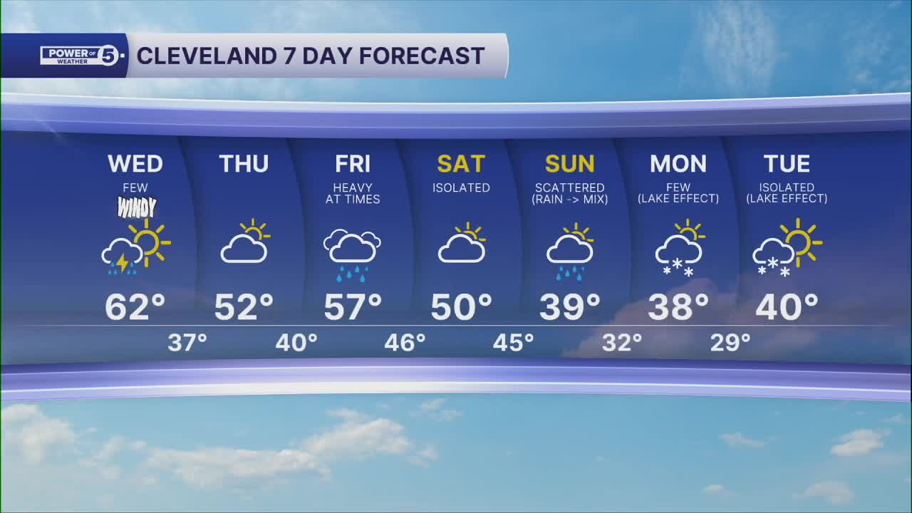


CLEVELAND — This week is relentless... wave after wave of rain, wind and chilly temps. We rebound nicely between rounds but it's brief.
Today's front is a strong one. The biggest impact will be from the wind. For most of NEO, wind will gust to 40 mph. May even see 50mph closer to the lake shore. A wind advisory has been issued for Cuyahoga, Lake, Lorain, and northern Ashtabula Counties from 1 pm to 10 pm. Peak winds will be along the front this afternoon. Winds shift from the southwest to the northwest... pick up to near gale-force and push t-showers across NE OH. Wet and windy for the evening commute.
Thursday will be dry and cool, but this week's third cold front and best opportunity for rain will be en route! Rain, possibly heavy at times, is likely on Friday. And winds will be gusty again on Friday. A FOURTH cold front will move through on Saturday with a few more showers and will also usher in much colder air over the weekend. This is looking cold enough to support our first flakes of the season late on Sunday, Monday, and potentially Tuesday with some lake effect. 'Tis the season!
The average first snowfall for Cleveland is November 10th, and this would be right on time! Exact timing, totals, and impacts are all a big 'ol question mark this many days away, so be sure to stay tuned!
DAILY FORECAST:
Wednesday: War, windy & wet for a few spots. | High: 62º
Thursday: Calmer, clearer and cooler. | High: 52º
Friday: Soaked with heavy rain possible. | High: 57º
Saturday: Looking mainly dry. | High: 50º
Sunday: Mainly rain but much cooler. A wet flake late. | High: 40º
Want the latest Power of 5 weather team updates wherever you go? Download the News 5 App free now: Apple|Android
Click here to view our interactive radar.
Follow the News 5 Weather Team:
Trent Magill: Facebook & Twitter
Katie McGraw: Facebook & Twitter
Phil Sakal: Facebook & Twitter
Allan Nosoff: Facebook & Twitter
