


CLEVELAND — The trend of dry weather and warm temperatures continues across NEO. It has officially been 12 straight days without measurable rain at Cleveland's Hopkins Airport, and that streak is expected to grow to at least 15 days. The next *chance* for anything holds off until the second half of the weekend.
So, it is no surprise that the drought will continue to worsen. Looking back at the last 30 days, parts of NEO are running between 5x and 10x below the total amount of rainfall expected for that month-long stretch. This is one of the driest starts to September in years.
Since September 1st...
- CLE has only picked up 0.23 inches of rain (1.71'' below normal)
- Akron has only picked up a tenth of an inch (1.64'' below normal)
- And Mansfield has only received 0.03 inches (1.65'' below normal)
So will we ever see rain again!? Rain chances do start to increase on Sunday and into Monday of next week as a large storm approaches from the west. However, the area of high pressure responsible for this hot and dry weather will fight hard to keep that rain away from NEO. Showers appear to be few and far between on Sunday, but coverage and intensity could increase on Monday and Tuesday of next week. In the meantime, you will need to water your plants and yards, but we hope you also enjoy the sun and warmth!
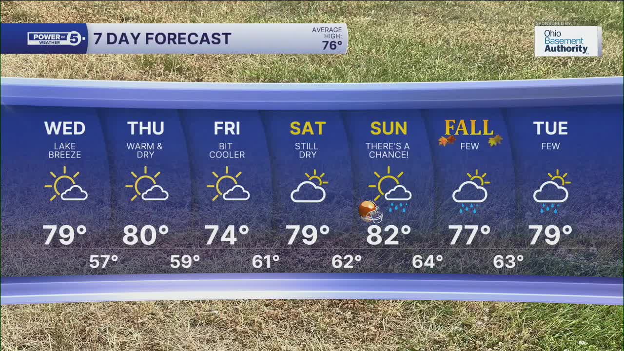
As for the warmth - get used to it! It looks like above-average temperatures will continue until late September and early October! Highs will be in the upper 70s to low 80s for the rest of the week and into next week.
DAILY FORECAST:
Tuesday Night: Mostly clear and comfortable. | Low: 58º
Wednesday: Bright & very warm. Afternoon lake breeze, so warmer inland. | High: 80º
Thursday: Mostly sunny & warm. Warmer inland | High: 80º
Friday: A few more clouds. Cooler temperatures.| High: 74º
Saturday: Partly sunny. Warm. | High: 79º
Sunday: There's a chance for a few showers! Warm.| High: 82º
Want the latest Power of 5 weather team updates wherever you go? Download the News 5 App free now: Apple|Android
Click here to view our interactive radar.
Follow the News 5 Weather Team:
Trent Magill: Facebook & Twitter
Katie McGraw: Facebook & Twitter
Phil Sakal: Facebook & Twitter
Allan Nosoff: Facebook & Twitter
