


CLEVELAND — Looking for a good time to get the car washed? Or take the Christmas lights down? This week is your week. We're thawing out nicely. It is finally above freezing on Monday afternoon with high temperatures in the low 40s. It has been below freezing officially for over 170 hours at Hopkins, the longest such stretch since last January.
Hope you enjoyed today's peeks of sun, if not mostly sunny skies at times, because more clouds are coming back overnight. There might be a refreeze tonight from the slush created by our melting snow, inland. Otherwise, just wet roads. Then, a few light rain showers will move in by mid-to-late morning Tuesday. That along with fog could cause visibility and road impacts, so be careful, primarily with some dense fog at times.
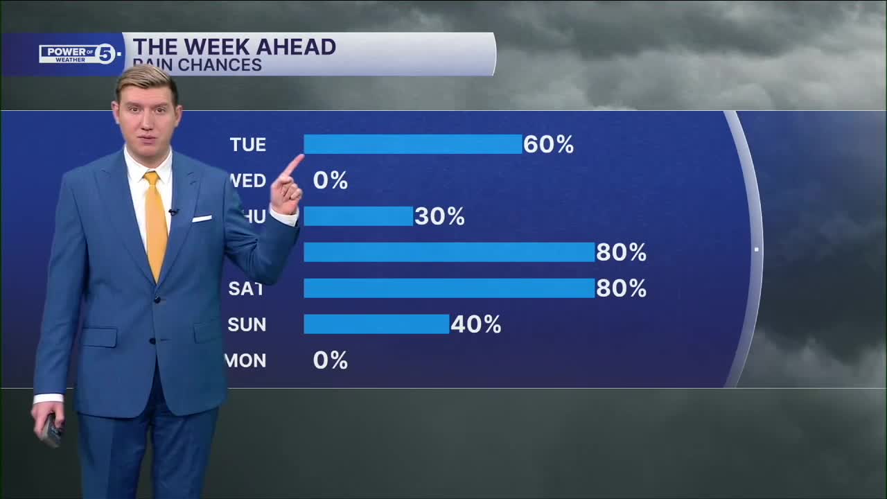
The rain later this week will be more impactful, with a multi-part, large storm, starting late Thursday and lasting through most of the weekend. Plan on a few showers and downpours Thursday evening and night, followed by heavier rain late Friday into early Saturday. Then, cold air comes crashing back down, switching the rain to snow into Sunday. Way too early for details and totals, but keep this in mind for potential weekend plan impacts.
DAILY FORECAST:
Tonight: Mostly cloudy. Watch out for isolated refreeze. | Low: 33º
Tuesday: Scattered light rain showers. | High: 45º
Wednesday: Cloudy & cooler but dry. | High: 40º
Thursday: Warmer with a few rain showers. | High: 50º
Friday: Warm and wet with heavy rain likely. | High: 56º
Want the latest Power of 5 weather team updates wherever you go? Download the News 5 App free now: Apple|Android
Click here to view our interactive radar.
Follow the News 5 Weather Team:
Trent Magill: Facebook & Twitter
Katie McGraw: Facebook & Twitter
Phil Sakal: Facebook & Twitter
Allan Nosoff: Facebook & Twitter
