



CLEVELAND —
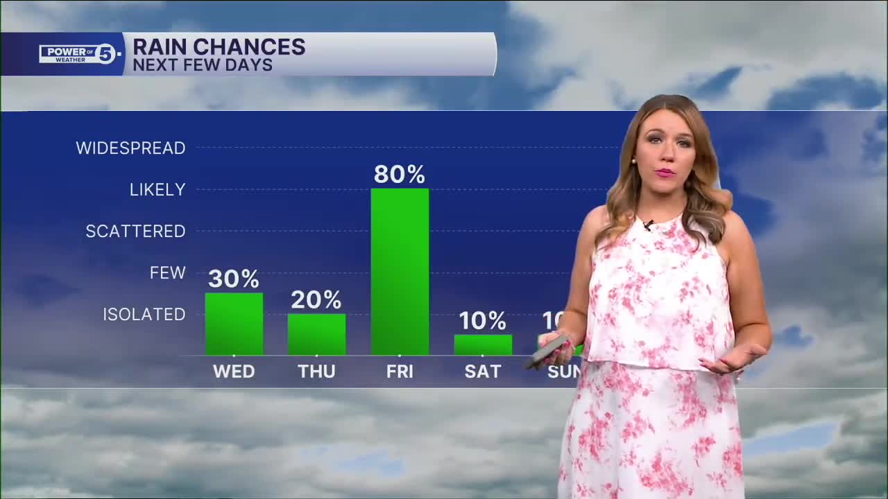
Rain is moving back into NEO starting on Wednesday
Clouds coming back this morning. Most of Northeast Ohio stay dry until this afternoon/eveing, though. Despite the cloud cover, we're still warming nicely. Thanks to a breezy southwest wind.
We're actually warmer today than we were yesterday with all of that sun! Southwesterly winds will help push our temperatures into the upper 70s. The clouds eventually lead to showers but they're mostly light. We'll call it a wet & mild PM Drive. Plan on even heavier rain by Friday (more details below). Showers will start in our West Region before spreading east across NEO closer to sunset. There is a better chance to see these showers Wednesday evening the farther north you live.
Power of 5 Regions Spotlight: West Region
The first region to see the return of showers will be the West Region. Plan on spotty light showers mid-afternoon. Rain may look widespread on Futurecast, but it will be very light. Rain will spread east during the evening commute. Most communities will pick up less than a tenth of an inch of rain, with isolated spots picking up around a quarter of an inch.
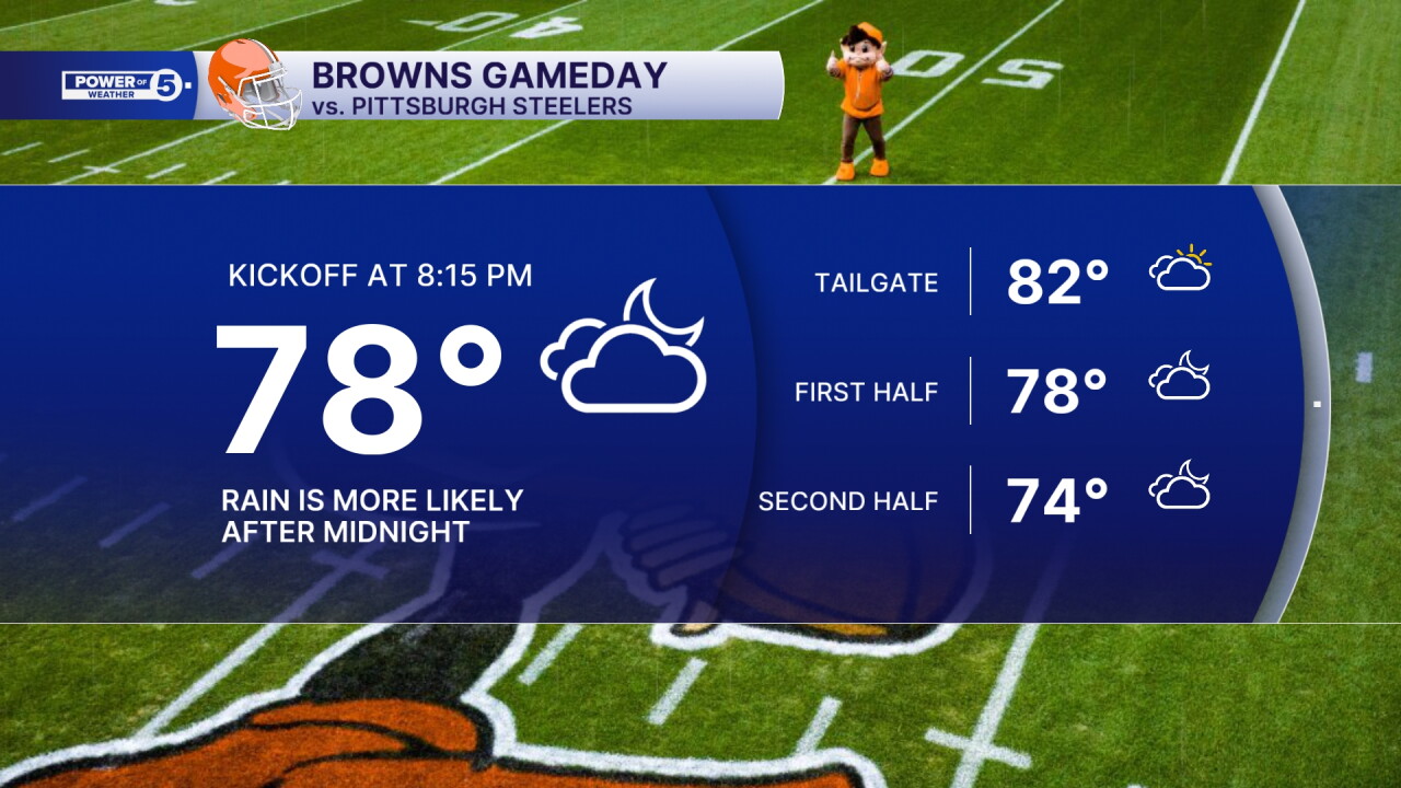
Thursday Night Football Forecast: Browns vs Steelers Game + When to expect widespread rain
A few lingering showers are possible Thursday morning, and while we cannot rule out an isolated pop-up storm, most of the day will be dry. Dry, hot & windy!
Those southwesterly gusts will push temps even higher. It will feel like summer again! Highs pushing near 80º for Thursday, so plan for a toasty tailgate! Temperatures will stay very warm throughout the entire game, with a slow drop into the mid- and low 70s by the second half of the game as the next round of rain approaches ahead of a cold front.
Most of the game looks dry. A brief t-shower is possible, but the widespread & heavier rain should hold off until closer to midnight. We will keep you posted on the timing!
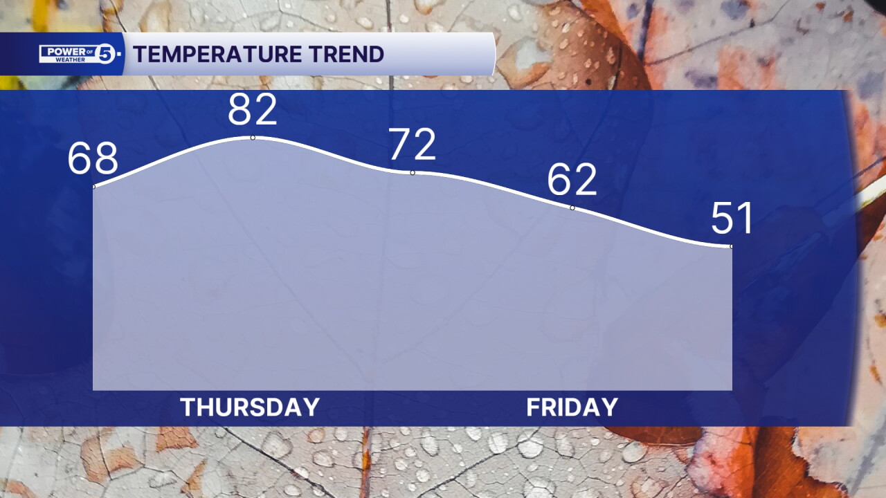
Friday is the wettest day of the week. Pockets of heavy rain will be possible, especially during the first half of the day. This rain will be heavier than Wednesday, with rainfall amounts around 0.5 to 1 inch of rain for the majority of NEO. It will also be one of those days where temps fall instead of rise, dropping from the low 70s around midnight to the upper 60s in the morning into the lower 60s by afternoon as the rain moves through. Plan for 50s by Friday evening.
The payoff comes this weekend. Sunshine returns, humidity stays low, and highs hold in the 60s. It'll feel much more like October across Northeast Ohio.
5-Day Forecast:
Wednesday: Even warmer, Light evening Showers.| High: 77º
Thursday: Summery afternoon & breezy. Isolated storm late. | High: 81º
Friday: Scattered rain and thunder with dropping temps. | High: 60s
Saturday: Drying and clearing, staying chilled. | High: 64º
Sunday: Bright but cool. | High: 67º
Learn the lingo: The Power of 5 Weather Team wants to get you your forecast closer to home. We have broken NEO into 5 separate and distinct regions. Find your region to get your hyper-local forecast!
- Cleveland Metro Region: Cuyahoga County. This region includes cities such as Cleveland, Parma, Westlake, Berea, Strongsville, Independence, Solon, Beachwood, and Euclid.
- Snowbelt Region: Lake, Geauga, and Ashtabula Counties. This includes cities such as Mentor, Geneva, Ashtabula, Bainbridge, Chardon, Burton, and Orwell.
- Akron-Canton Region: Summit, Stark, and Portage Counties. This region includes cities such as Akron, Canton, Hudson, Ravenna, Mantua, Alliance, and Canal Fulton.
- West Region: Lorain, Medina, Erie, Huron, Richland, and Ashland Counties. This region includes cities such as Lorain, Wellington, Medina, Lodi, Ashland, Mansfield, Willard, and Sandusky.
- South Region: Wayne, Holmes, Tuscarawas, Carroll Counties. This region includes Wooster, Millersburg, New Philadelphia, Strasburg, Mineral City, Carrollton, and Newcomerstown
You can send us photos and short videos by filling out the form below:
Want the latest Power of 5 weather team updates wherever you go? Download the News 5 App free now: Apple|Android
Click here to view our interactive radar.
Follow the News 5 Weather Team:
Trent Magill: Facebook & Twitter
Katie McGraw: Facebook & Twitter
Phil Sakal: Facebook & Twitter
Allan Nosoff: Facebook & Twitter
