



CLEVELAND — Temperatures continue to creep up a couple of degrees each day. That includes nights too! So tonight/early Saturday will be in the upper 50s inland to the mid 60s along the lakeshore. Plan for variable clouds tonight with only a slim shot at a shower.
Saturday looks similar. Very warm. A stray shower can't be ruled out early in the day, mainly east of I-77, but much of the afternoon will be dry with a mix of sun and clouds, with temps reaching the lower 80s and slightly more humidity in the air. Any outdoor plans should be in pretty good shape through Saturday
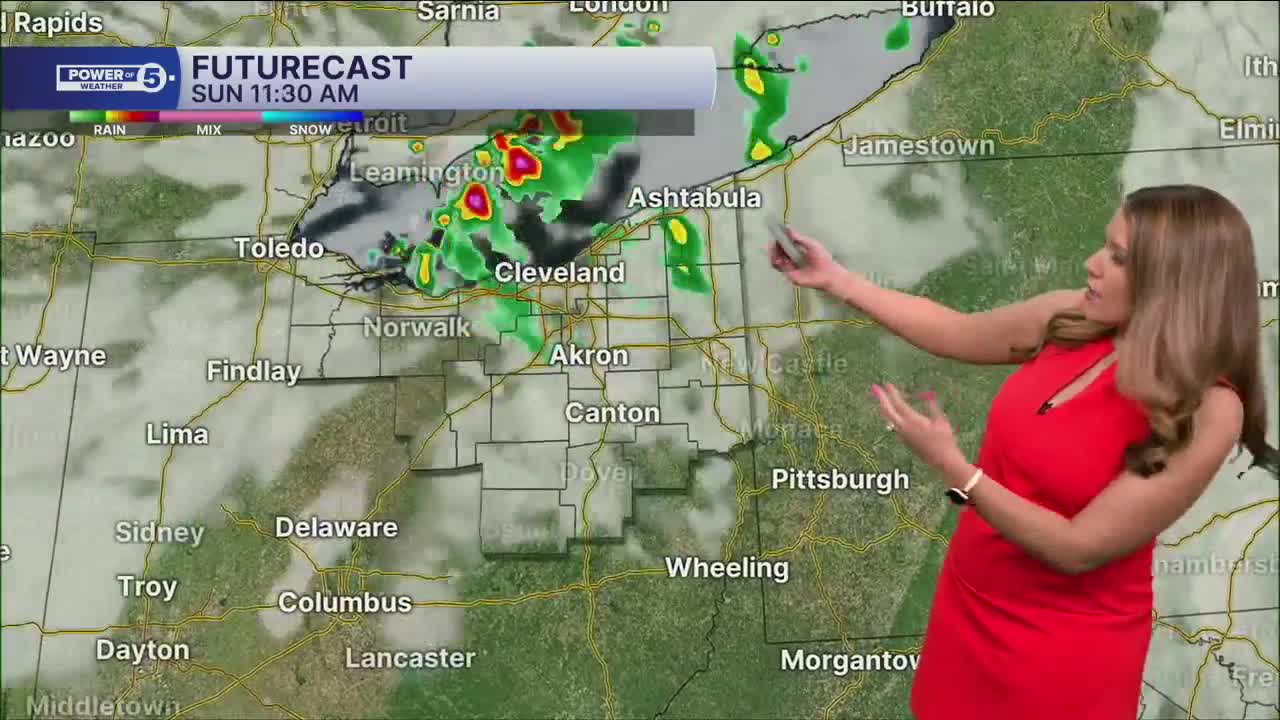
The weather starts to turn a little more unsettled by the second half of the weekend. A few storms are possible Sunday afternoon and evening with even more heat and humidity. Temperatures will be flirting with the upper 80s and low 90s on Sunday and Monday.
Speaking of Monday, the chance for rain becomes more widespread as another system approaches. It looks like rounds of showers and storms will be possible. Severe storms that could produce damaging winds will be possible. Heavy rain will also be possible into Tuesday.
We will keep you posted all weekend long regarding the chance for damaging storms early next week. Stay tuned!
DAILY FORECAST:
Friday Night: Variable clouds. Bit warmer. | Low: 63º
Saturday: Partly cloudy with a slim chance of rain. | High: 82º
Sunday: Few showers. Thunder possible. | High: 86º
Monday: Scattered storms. Could be strong or severe. Hot and humid. | High: 89º
Tuesday: Few storms. Cooler but still humid. | High: 80º
Want the latest Power of 5 weather team updates wherever you go? Download the News 5 App free now: Apple|Android
Click here to view our interactive radar.
Follow the News 5 Weather Team:
Trent Magill: Facebook & Twitter
Katie McGraw: Facebook & Twitter
Phil Sakal: Facebook & Twitter
Allan Nosoff: Facebook & Twitter
