

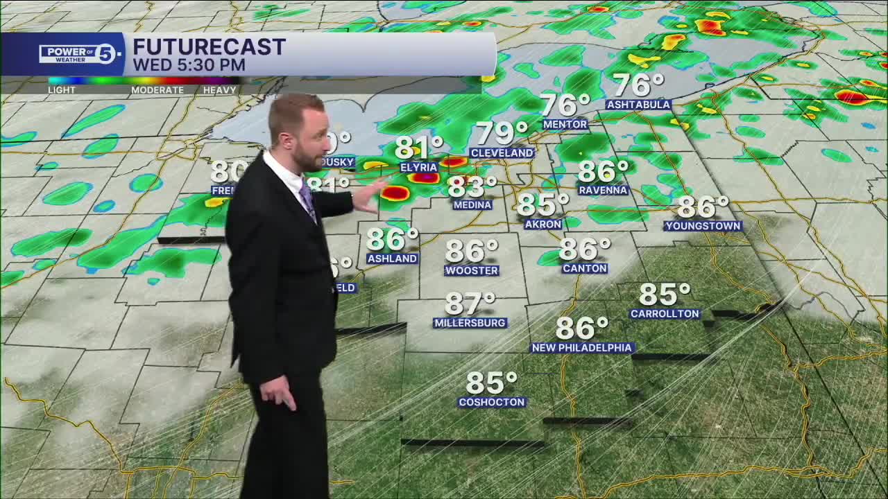


CLEVELAND — Clouds continue to increase tonight, and the breeze begins to increase. Wednesday morning will be warm and muggy, with most areas holding in the upper 60s.
Wednesday turns noticeably hotter and more humid. Temps surge into the mid to upper 80s and a few spots could touch 90 degrees by afternoon. That heat and humidity will help fuel thunderstorms late in the day as a cold front moves through. Heat index values will be well into the low to mid 90s during peak heating
Some storms could become strong or even damaging, especially in the late afternoon and evening. We'll continue to fine-tune the timing and threat as we get closer.
Behind the front, Thursday looks much cooler with highs in the 70s and a few lingering showers possible early. The cooler air doesn't stick around for long, though. Temps bounce back into the 80s for the upcoming weekend.
Power of 5 Regions Highlight: West Region (Wednesday)
The entire area enjoys a beautiful day today, but Wednesday's weather will vary by region.
West Region: The hottest air is likely west of Cleveland, where temps have the best chance of reaching 90 degrees before storms arrive late in the day. Storms approach from the west first, so make sure you have a plan and a way to get alerts.
5-Day Forecast
Wednesday: Warmer and humid with strong afternoon thunderstorms. | High: 87º
Thursday: Cooler. Few showers, especially south. | High: 74º
Friday: Comfortable. Partly cloudy. | High: 76º
Saturday: Slim shot of shower. Warmer. | High: 83º
Sunday: Isolated t'shower. Warm. | High: 81º
Learn the lingo: The Power of 5 Weather Team wants to get you your forecast closer to home. We have broken NEO into 5 separate and distinct regions. Find your region to get your hyper-local forecast!
- Cleveland Metro Region: Cuyahoga County. This region includes cities such as Cleveland, Parma, Westlake, Berea, Strongsville, Independence, Solon, Beachwood, and Euclid.
- Snowbelt Region: Lake, Geauga, and Ashtabula Counties. This includes cities such as Mentor, Geneva, Ashtabula, Bainbridge, Chardon, Burton, and Orwell.
- Akron-Canton Region: Summit, Stark, and Portage Counties. This region includes cities such as Akron, Canton, Hudson, Ravenna, Mantua, Alliance, and Canal Fulton.
- West Region: Lorain, Medina, Erie, Huron, Richland, and Ashland Counties. This region includes cities such as Lorain, Wellington, Medina, Lodi, Ashland, Mansfield, Willard, and Sandusky.
- South Region: Wayne, Holmes, Tuscarawas, Carroll Counties. This region includes Wooster, Millersburg, New Philadelphia, Strasburg, Mineral City, Carrollton, and Newcomerstown
You can send us photos and short videos by filling out the form below:
Want the latest Power of 5 weather team updates wherever you go? Download the News 5 App free now: Apple|Android
Click here to view our interactive radar.
Follow the News 5 Weather Team:
Trent Magill: Facebook & Twitter
Katie McGraw: Facebook & Twitter
Phil Sakal: Facebook & Twitter
Allan Nosoff: Facebook & Twitter
