


UPDATE:
Morning showers have come to an end. There will be a lull in the activity for most of the afternoon with colder temperatures, breezy winds and breaks in the clouds! By this evening, our focus shifts toward tonight's and Friday morning's snow.
LATEST ALERTS:
A Winter Weather Advisory has been issued for Cuyahoga, Lake, inland Ashtabula and Geauga counties. It goes into effect at 7 pm Thursday until 12 pm Friday. This is the first advisory issued this season, but not everyone will be treated the same during this event.
UPDATE: The winter storm watch has been changed to a winter weather advisory. This advisory now includes Cuyahoga, Lake, Geauga and inland Ashtabula Counties. It is in effect from 7 pm tonight until noon tomorrow. Plan on accumulating snow, lowered visibility and slippery roads. pic.twitter.com/FjSV9KfCiR
— Katie McGraw (@KatieMcGrawx) November 18, 2021
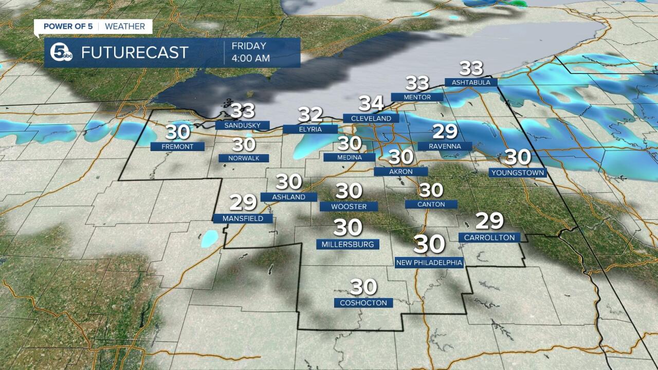
TIMING:
This is a short lake effect event. A wintry mix/snow will start this evening and continue into Friday morning. The worst of the snow looks to be from about 12 am - 5 am. Snow showers will taper off throughout Friday morning. High pressure will build by Friday afternoon and drier weather will return.


IMPACTS:
Plan on accumulating snow especially in the advisory area. Where squalls set up and persist long enough, periods of heavy snow and low visibility/white out conditions will be possible. Give yourself extra time Friday morning. The roads could be slick or even snowy. This is particularly true in the primary Snowbelt. You may even hear some thunder snow!

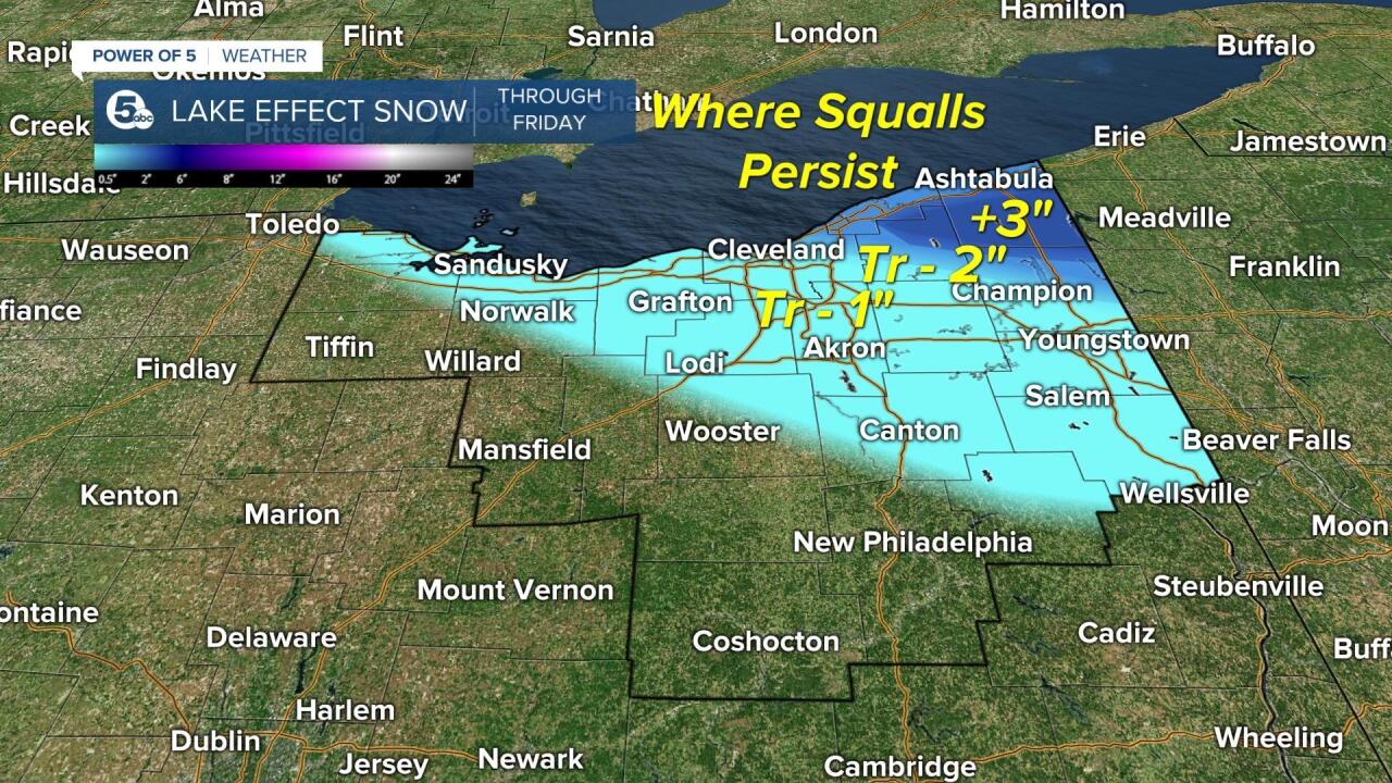
SNOW TOTALS:
Below is The Power of 5 forecast for snow fall totals through Friday. Expect 1-3'' for many areas across NE Ohio. Most will see a covering of snow. The greatest impacts/highest totals of 3''+ are expected in the snowbelt (Geauga/inland Ashtabula Counties). Notice accumulating snow is not in the forecast for all our viewing area and lower amounts are expected the more south and west you live. Lower totals are also expected along the immediate lake-shore due to the warm air near Lake Erie. The snow will be out in a relatively short amount of time which will limit snow totals. Keep in mind there will likely be localized higher totals in the area in dark blue. The Power of 5 meteorologists will keep you posted on updates throughout Thursday and Friday. Stay safe!
Want the latest Power of 5 weather team updates wherever you go? Download the News 5 App free now: Apple|Android
Download the StormShield app for weather alerts on your iOS and Android device: Apple|Android
Click here to view our interactive radar.
Read and watch the latest Power of 5 forecast here.
Follow the News 5 Weather Team:
Mark Johnson: Facebook & Twitter
Remeisha Shade: Facebook & Twitter
