


CLEVELAND — This weekend was gorgeous, warm and summery. But the week ahead is a wild ride. There is something for everybody this week - starting with storms returning to northeast Ohio on Monday.
An area of low pressure to our northwest will slide toward the area and drag a cold front through Northeast Ohio on Monday. This will bring widespread showers and storms tomorrow.

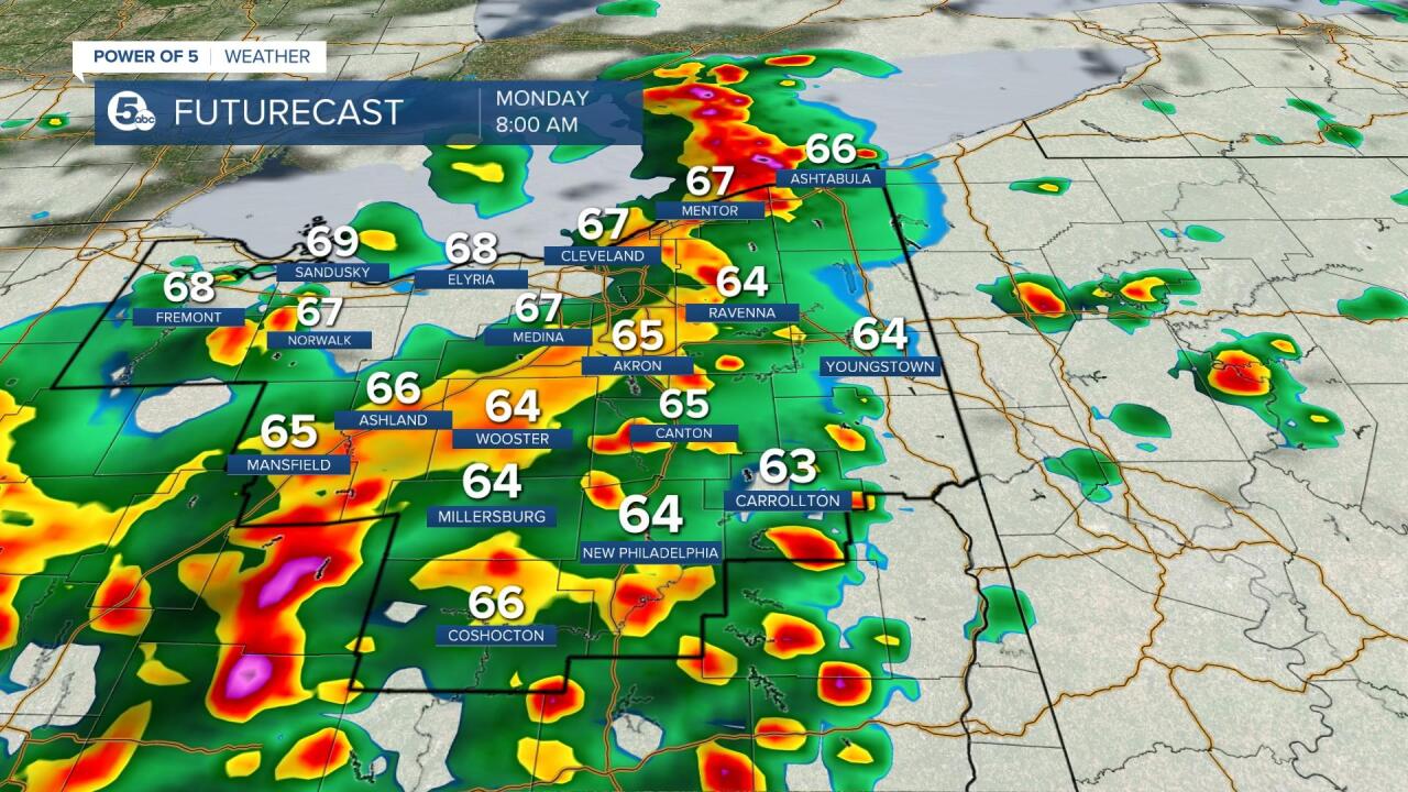
Overnight, a few showers are possible but will increase in coverage between 4 - 6 a.m. Monday. Plan for widespread showers and a soggy start to the school/work week.
During the afternoon, a lull is expected with most locations drying up. However, additional storms are expected to develop during the afternoon. There is a conditional and isolated threat for severe weather Monday afternoon. We will be watching for a few strong/severe wind gusts and large hail.
Scroll through the images of Futurecast to get an idea about timing and coverage.


Tuesday will be predominately dry, but a strong system moves through the middle of the week. This system will feature more storms and a stronger cold front. Once again, strong to severe storms will be possible. PLUS, the cold front will usher in MUCH cooler air. Highs on Friday could be in the 50s. That will be about a 20-25 degree drop from Wednesday afternoon.
Be sure to tune into News 5 all week long to get the latest information from the Power of 5 Weather Team!

Want the latest Power of 5 weather team updates wherever you go? Download the News 5 App free now: Apple|Android
Download the StormShield app for weather alerts on your iOS and Android device: Apple|Android
Click here to view our interactive radar.
Read and watch the latest Power of 5 forecast here.
Follow the News 5 Weather Team:
Mark Johnson: Facebook & Twitter
