


CLEVELAND — Rain and storms are likely across NE Ohio on Tuesday. Rain will become widespread during the mid/late morning as a warm front lifts north through the area. After a brief lull in the activity, a second wave of showers and storms is likely this afternoon and evening ahead of a cold front. A few storms could become strong or severe Tuesday afternoon and evening.

The Storm Prediction Center has expanded and upgraded the risk for severe weather over the last 24 hours for Ohio. A slight risk is a level 2/5 and has been issued for many communities south of Cleveland. It includes Canton, Wooster, and New Philly. A slight risk for severe weather means organized severe storms are possible, but typically feature varying levels of intensity. Additionally, severe storms will not affect everyone in the viewing area. The severe risk is not zero in our northern communities, but there is a better chance in the southern half.

All modes of severe weather will be possible with the thunderstorms expected to develop this afternoon and evening. The main concern is damaging straight-line winds and locally heavy rain that could lead to flooding. However, hail will also be possible. Isolated spin-ups/tornadoes cannot be ruled out. Rainfall amounts could be hefty! Figure half inch on the low end and 1.5 to 2 inches on the high end.

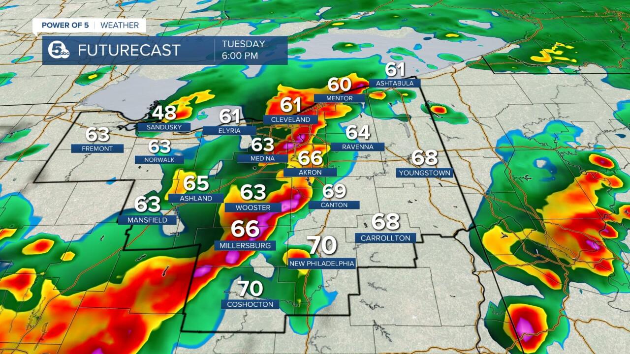
Rain will become widespread after 10 am. This first wave of showers is expected to end in the early afternoon, but a second wave will be moving in shortly after a brief lull. If the two rounds are too close together, severe weather will be difficult to develop. Thunderstorms become more likely after 2 p.m. through 10 p.m. this evening. Showers will linger until Wednesday morning - especially in our northern/lake shore communities. The cold front will also dramatically drop the temperatures by Wednesday with highs in the mid-50s.
Scroll through images of Futurecast to get an idea about timing and coverage. Be sure to keep updated with the Power of 5 Weather Team for the latest information throughout the day.


Want the latest Power of 5 weather team updates wherever you go? Download the News 5 App free now: Apple|Android
Download the StormShield app for weather alerts on your iOS and Android device: Apple|Android
Click here to view our interactive radar.
Read and watch the latest Power of 5 forecast here.
Follow the News 5 Weather Team:
Mark Johnson: Facebook & Twitter
Remeisha Shade: Facebook & Twitter
