


CLEVELAND — Update: All Severe Thunderstorm Watch and Warnings have been canceled.
A Severe Thunderstorm Warning has been canceled for Portage County Wednesday as the strength of wind gusts decreases to 30-40 mph.
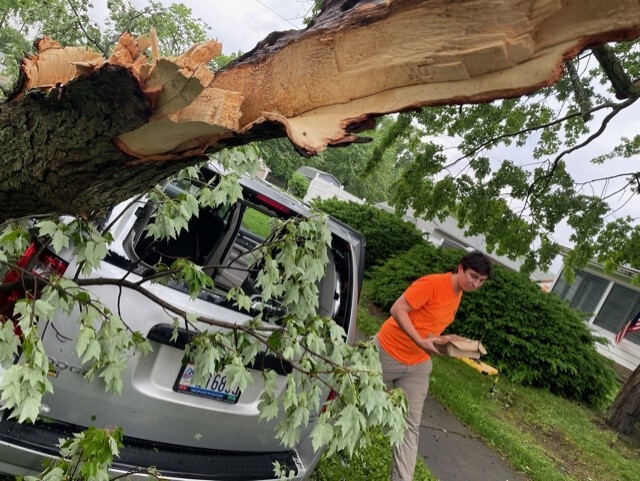
A large tree fell on a parked car on Lansing Drive in Akron. Akron was under a Severe Thunderstorm Warning. At one point during the storm, 60 mph wind gusts were reported.


A Severe Thunderstorm Watch remains in effect for Holmes, Portage, Summit, Stark, Mahoning, Trumbull and Wayne counties.
The watch is in effect from 1 p.m. to 8 p.m. Wednesday.
The best chance for severe storms is east of I-77.
The main threat for today is damaging wind gusts that exceed 50 mph. There is also the possibility of isolated large hail. The tornado threat is low, but not zero. We are in need of some rain, but heavy rain is likely in the strongest storms.
Severe Thunderstorm Warnings were briefly issued for Portage, Summit and Stark counties at around 1:15 p.m. Wednesday, but those warnings were downgraded back to watches at around 2 p.m.
RELATED: Strong to severe storms with damaging wind gusts possible Wednesday
Want the latest Power of 5 weather team updates wherever you go? Download the News 5 App free now: Apple|Android
Download the StormShield app for weather alerts on your iOS and Android device: Apple|Android
Click here to view our interactive radar.
Read and watch the latest Power of 5 forecast here.
Follow the News 5 Weather Team:
Mark Johnson: Facebook & Twitter
