


April is a transitional month, and spring is a transitional season! If we look at the first three Thursdays of April 2021, you will see a grab bag of conditions. On April 1, we picked up 3.7 inches of snow at Hopkins. That is more snow than we typically see the entire month! By April 8, temperatures soared to record levels in the low 80s. By last Thursday, temperatures had fallen yet again into the upper 40s with light rain. This Thursday looks to have more snow showers...

The Yo-Yo conditions will continue this week! It will be fairly mild today and tomorrow, before our next system moves toward Northeast Ohio. It is currently positioned to our northwest and will slide toward Northeast Ohio by Monday/Tuesday.

Please note this is a first look at this system. The exact track, timing and totals are still uncertain. The Power of 5 Weather Team will be tailoring this forecast and get into the specifics over the next couple of days.

As the cold front moves through, it will drop our temperatures significantly from Monday to Wednesday. Most of Wednesday will be in the 30s!!

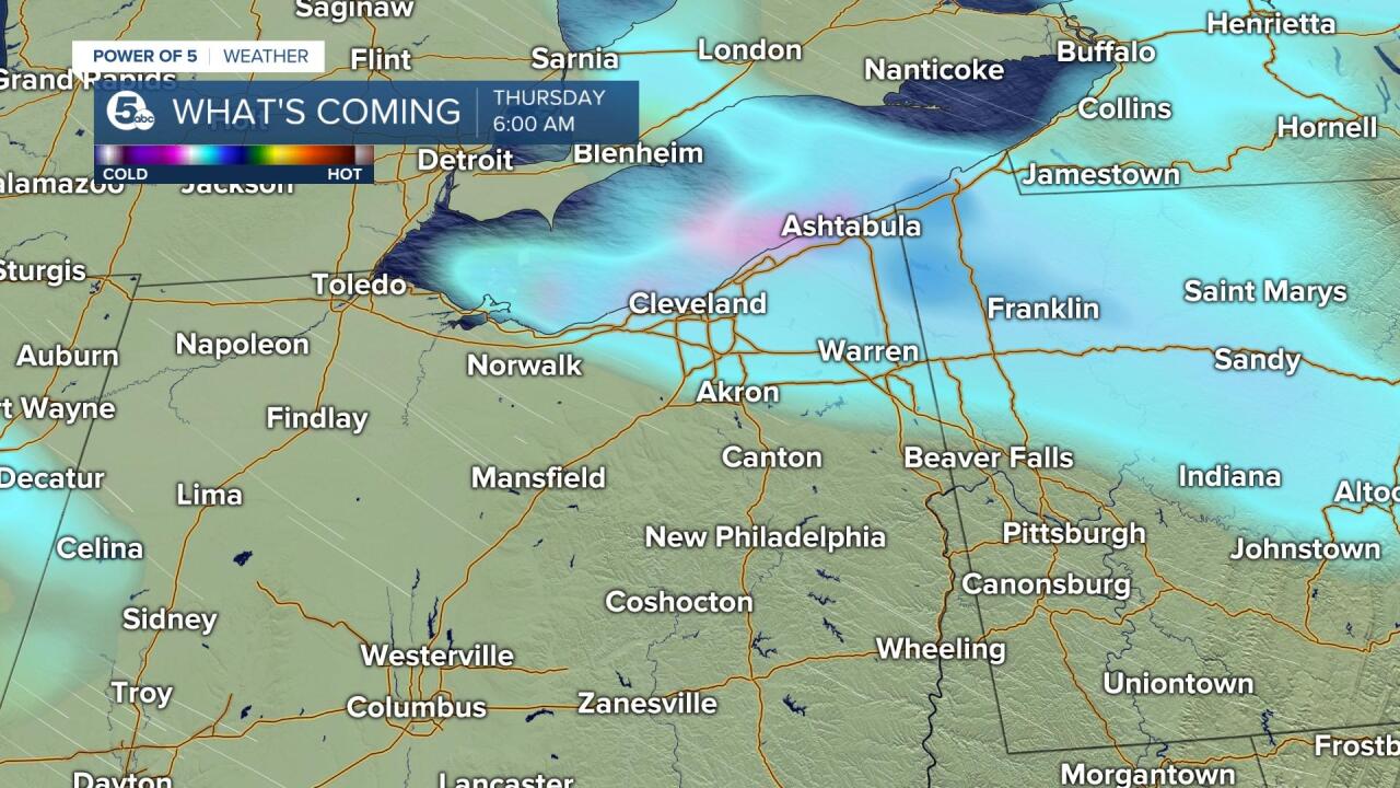
Precipitation will follow the cold front. The first sign of this system will be increasing clouds on Monday. A few showers are possible early Tuesday, but the main event looks to hold off until Tuesday evening. There will be a wide range of temperatures on Tuesday. Chilly to the north and fairly mild to the south (40s vs 60s). Precipitation looks to start as rain late on Tuesday and then transition to a wintry mix and eventually all snow by Wednesday. The lake effect snow machine will then be activated for Thursday (especially early).
Models are coming into agreement on the timing and intensity of this storm... the reality is often widely ranged when it comes to late-season snows though. Impacts will be widespread. Plan on a snowy Wednesday morning for everyone and a snow Thursday morning drive where the lake effect sets up. When all is said and done and this system wraps up and heads off the East Coast, we'll be left with quickly melting snow. If you're a go-getter, you may have enough to shovel before Friday's sun melts it.
Be sure to keep it with News 5 all of this week. Mark, Trent, Remeisha and I will be keeping a pulse on this storm and updating the forecast as needed.


Want the latest Power of 5 weather team updates wherever you go? Download the News 5 App free now: Apple|Android
Download the StormShield app for weather alerts on your iOS and Android device: Apple|Android
Click here to view our interactive radar.
