


CLEVELAND — A warm front moves in by Sunday morning, and an initial burst of moderate rain is expected, most likely around 8 or 9 a.m. Sunday morning. Temperatures will then soar into the 50s and 60s by late Sunday afternoon, along with increasing wind. Most of the heavy rain will likely stay north over the lake, but occasional isolated downpours are possible the rest of the day, especially north of Akron, which means some rain is likely for the Browns game.
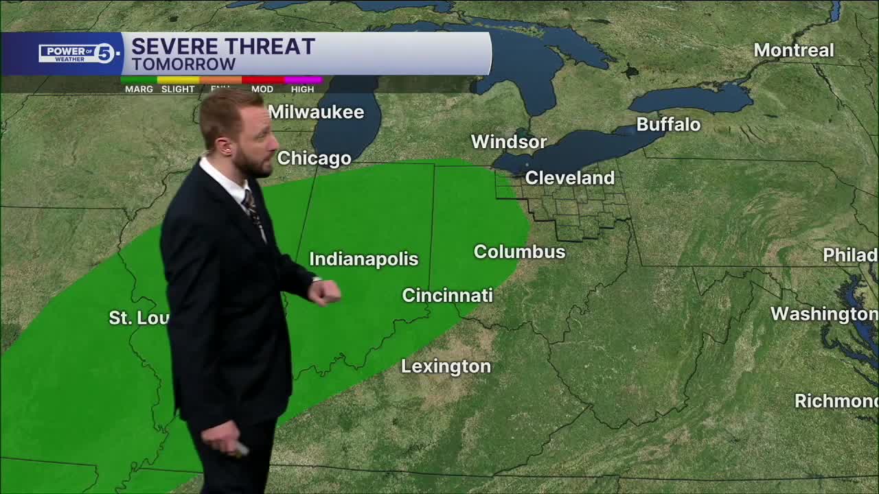
Wind gusts of 40 to 50+ mph are likely Sunday night into Monday as a cold front blasts through with a chance of severe thunderstorms. The cold front is likely to cross Northern Ohio on either side of midnight. The cold front could bring isolated strong to severe storms, with damaging winds and minor flooding being the main threats.
Behind the cold front, a temperature tumble will bring 20s back to the area by mid-morning Monday. Rain to snow showers are possible early Monday as temperatures drop. Lake effect takes over by Monday evening, with a burst of moderate snow possible for the evening commute Monday with a few fluffy inches of snow possible for most. Lake effect could continue through Tuesday evening, with 6 inch potential in the primary snowbelt, where squalls persist.
The lake effect snow takes a brief break Tuesday night into Wednesday, but returns as the ball drops Wednesday night alongside another clipper. A few more inches of snow are possible ringing in 2026. It will feel frigid with temperatures topping out near 20 and lows near 10-15.
DAILY FORECAST:
Sunday: Scattered showers and a few strong t-storms possible. Windy & warm. | High: 62º
Monday: Temperatures Tumble. Lake effect snow possible. | High: 25º
Tuesday: Breezy & cold. Lake effect snow possible. | High: 27º
New Year's Eve: Cold. Lake effect snow possible. | High: 29º
New Year's Day: Cold to start 2026. Lake effect snow possible. | High: 22º
Friday: Even colder. Lake effect snow possible. | High: 19º
Want the latest Power of 5 weather team updates wherever you go? Download the News 5 App free now: Apple|Android
Click here to view our interactive radar.
Follow the News 5 Weather Team:
Trent Magill: Facebook & Twitter
Katie McGraw: Facebook & Twitter
Phil Sakal: Facebook & Twitter
Allan Nosoff: Facebook & Twitter
