


CLEVELAND — The heat will continue as we begin the new week! Highs will once again top off in the low to mid 80s on Sunday and Monday. That is a good 10 to 15 degrees above average for the first week of October! Skies will be sunny for the second half of the weekend, but we can expect more clouds to appear as we begin the new work week.
Our stretch of dry days will finally come to an end on Tuesday. Plan on scattered rain on Tuesday and Wednesday, followed by much cooler air mid-week. We actually look to fall BELOW average by then! The storms on Tuesday afternoon could be strong to severe. Stay tuned for updates.
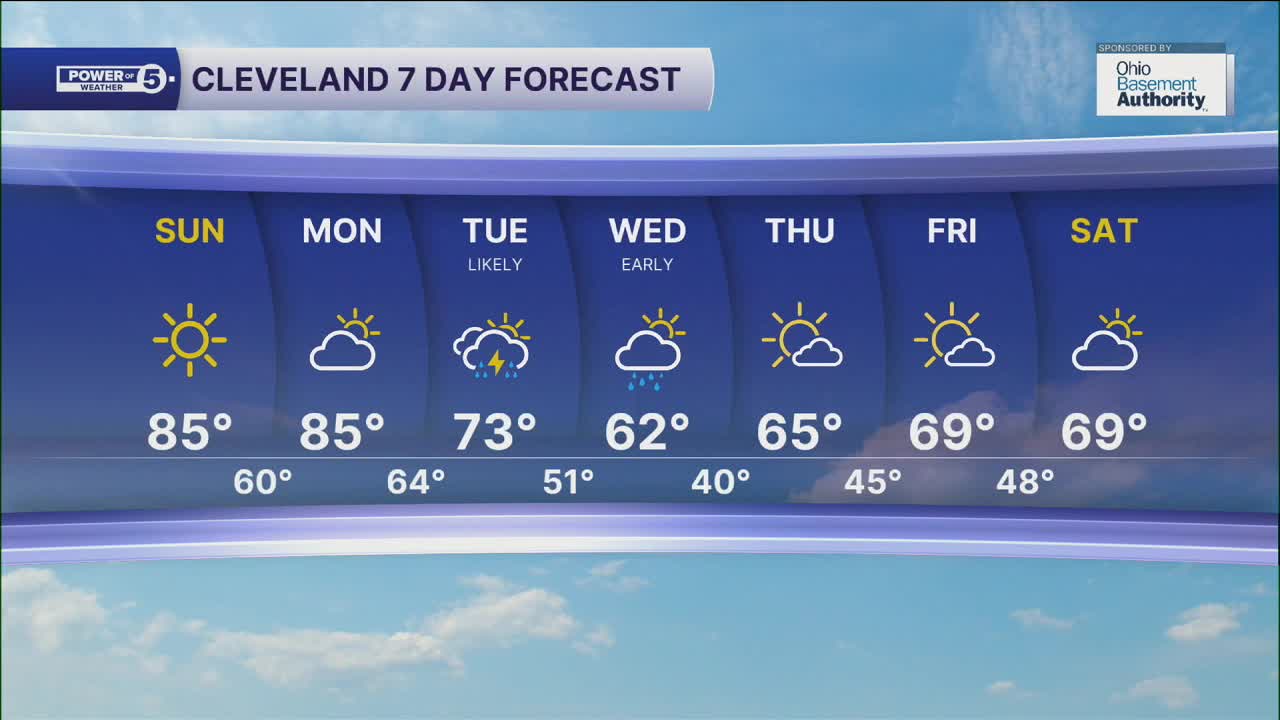
DAILY FORECAST:
Sunday: Super sunny & very warm. | High: 85º
Monday: More clouds but staying very warm. | High: 85º
Tuesday: Scattered rain showers and t-storms as cooler air rushes in. | High: 73º
Wednesday: Few lingering showers, much cooler. | High: 62º
Thursday: Drier and seasonable. | High: 65º
Friday: Partly cloudy and seasonable.| High: 69º
Saturday: Partly sunny. Seasonable. | High: 69º
Want the latest Power of 5 weather team updates wherever you go? Download the News 5 App free now: Apple|Android
Click here to view our interactive radar.
Follow the News 5 Weather Team:
Trent Magill: Facebook & Twitter
Katie McGraw: Facebook & Twitter
Phil Sakal: Facebook & Twitter
Allan Nosoff: Facebook & Twitter
