


CLEVELAND — A second round of storms rolled through this evening, packing a punch stronger than Tuesday morning's showers with heavier rain, lightning, and gusty winds. These cleared NEO around 9-10 pm, but we are not done with the rain! Plan for on and off showers (and some downpours) over the next two days.
This system/low pressure will hang around until Thursday evening, as cooler air moves over a warm Lake Erie. This will all bring more lake effect showers on Wednesday and Thursday. Some heavy rain will be possible, especially in the "rain belts" of Lake and Ashtabula Counties. 1-3 inches of rain will be possible there. Elsewhere across NEO, rainfall totals will be much lower, with most folks picking up a tenth to a half an inch of rain over the next 48 hours.
It will be breezy as well with gusts up to 40 mph on Wednesday and up to 30 mph on Thursday.
It will also be chilly! Temperatures will remain well below average for most of the week, with highs in the low 50s for the next two days. With those blustery winds, it will feel even colder. Yep - we are talking about wind chills again! The first time in months!
There looks to be a gradual increase by this weekend and early next week, with more seasonable temperatures in the upper 50s and low 60s. Speaking of the weekend, it is looking dry! So we just need to get through the next 48 hours before calmer October weather returns.
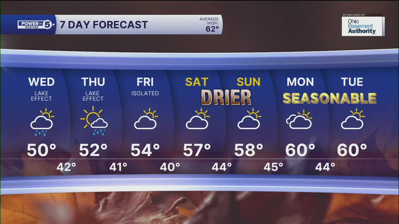
DAILY FORECAST:
Tuesday Night: Mostly cloudy, a couple of showers.| Low: 42º
Wednesday: Lake Effect Showers. Cooler again. | High: 50º
Thursday: Lingering showers. Coolest day. | High: 55º
Friday: Partly sunny. Not as cool but drier. | High: 56º
Saturday: Few showers. Touch warmer. | High: 55º
Sunday: Shower chances continue. | High: 57º
Want the latest Power of 5 weather team updates wherever you go? Download the News 5 App free now: Apple|Android
Click here to view our interactive radar.
Follow the News 5 Weather Team:
Trent Magill: Facebook & Twitter
Katie McGraw: Facebook & Twitter
Phil Sakal: Facebook & Twitter
Allan Nosoff: Facebook & Twitter
