



CLEVELAND — Keep the rain jacket close today. Keep the heavier winter coat on standby for tomorrow.
Steady light to moderate rain will make the AM drive a soggy one with temps near 50. Roads will be wet and the wind will be noticeable all day, so give yourself a little extra time getting around this morning.
We do catch somewhat of a break this afternoon. There will be more dry time, but it comes as colder air starts taking over.
And we’re not done with the rain.
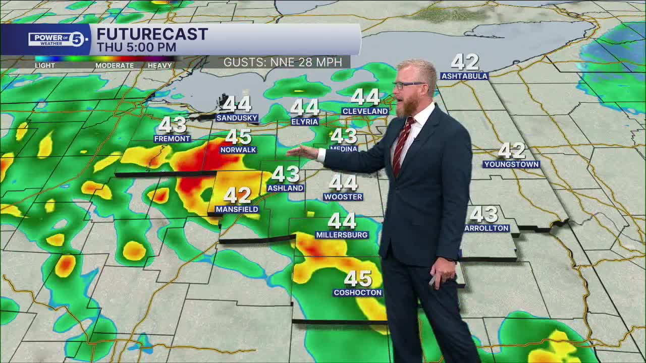
Another shot of colder air arrives later today and helps spark another round of showers. Lake Erie will give some of that rain an extra boost. The lake is still relatively warm for November, so cold air blowing across it can grab more moisture and keep the showers going.
With a northeast wind, the heaviest and most persistent rain should favor areas west of Cleveland.
If you’re trying to squeeze in yard work, a dog walk or a quick run outside, the afternoon offers more opportunities than the morning. Just keep an eye on the sky because the dry stretches won’t necessarily last. Especailly in the West Region.
West Region: Watch for heavier downpours this afternoon
The West Region is the spot to watch as we get into the afternoon.
While much of Northeast Ohio gets a break from the steadier morning rain, another round of showers develops later today. With a northeast wind blowing across relatively warm Lake Erie, those showers can grab some extra moisture before moving into areas west of Cleveland.
That gives the West Region the best opportunity for a few heavier downpours this afternoon.
If you’re heading out, keep the rain gear nearby even if it’s dry when you leave. Rain could come down pretty hard for a short time, leaving roads extra wet and visibility briefly reduced.
And don’t plan on a warm afternoon. Colder air will be moving in at the same time, with a gusty wind adding to that raw November feel.
Could we actually see snowflakes Friday morning?
Yep.
Winds turn more northerly tonight, allowing lake-effect showers to get going while temps fall into the 30s. By early Friday, some cold rain can mix with wet snowflakes.
Before anybody starts hunting for the snow shovel, there are a couple important things to remember.
The ground is warm. Air temps are expected to stay above freezing. That means most wet snow that falls will melt pretty quickly.
There could be a few heavier bursts where some brief, minor slush tries to collect, but widespread accumulation isn’t the expectation.
For the early Friday drive, plan more for cold, wet and occasionally sloppy weather rather than a full-blown winter commute.
The cold sticks around
This isn’t a one-morning chill.
Highs only reach the lower 40s through the weekend, with overnight temps dropping into the 30s. It’s heavier-coat weather, especially with wind making it feel even colder at times.
Saturday stays chilly with lake-effect showers still possible.
Things finally improve Sunday as the wind shifts and pushes most of the lake effect away. We’ll get more sunshine back, which will certainly make the day look better.
It won’t make it much warmer.
Want 50s again? We’ll have to wait until Tuesday.
5-Day Forecast:
Thursday: Soaked with (at times, heavy) chilly rain. | High: 47º
Friday: Showers continue. 1st flakes for some. Colder. | High: 40º
Saturday: Lake effect rain/snow showers. Chilly. | High: 43º
Sunday: Isolated lake effect rain/snow showers. Chilly. | High: 47º
Monday: More sun but still cool. | High: 47º
Learn the lingo: The Power of 5 Weather Team wants to get you your forecast closer to home. We have broken NEO into 5 separate and distinct regions. Find your region to get your hyper-local forecast!
- Cleveland Metro Region: Cuyahoga County. This region includes cities such as Cleveland, Parma, Westlake, Berea, Strongsville, Independence, Solon, Beachwood, and Euclid.
- Snowbelt Region: Lake, Geauga, and Ashtabula Counties. This includes cities such as Mentor, Geneva, Ashtabula, Bainbridge, Chardon, Burton, and Orwell.
- Akron-Canton Region: Summit, Stark, and Portage Counties. This region includes cities such as Akron, Canton, Hudson, Ravenna, Mantua, Alliance, and Canal Fulton.
- West Region: Lorain, Medina, Erie, Huron, Richland, and Ashland Counties. This region includes cities such as Lorain, Wellington, Medina, Lodi, Ashland, Mansfield, Willard, and Sandusky.
- South Region: Wayne, Holmes, Tuscarawas, Carroll Counties. This region includes Wooster, Millersburg, New Philadelphia, Strasburg, Mineral City, Carrollton, and Newcomerstown
You can send us photos and short videos by filling out the form below:
Want the latest Power of 5 weather team updates wherever you go? Download the News 5 App free now: Apple|Android
Click here to view our interactive radar.
Follow the News 5 Weather Team:
Trent Magill: Facebook & Twitter
Katie McGraw: Facebook & Twitter
Phil Sakal: Facebook & Twitter
Allan Nosoff: Facebook & Twitter
