


CLEVELAND — The messy mix of wet snow, rain, and sleet from this morning has departed, leaving only a short break in the precipitation midday.
The wind is still strong. Gusting to 40 mph. That will continue through the remainder of the day.
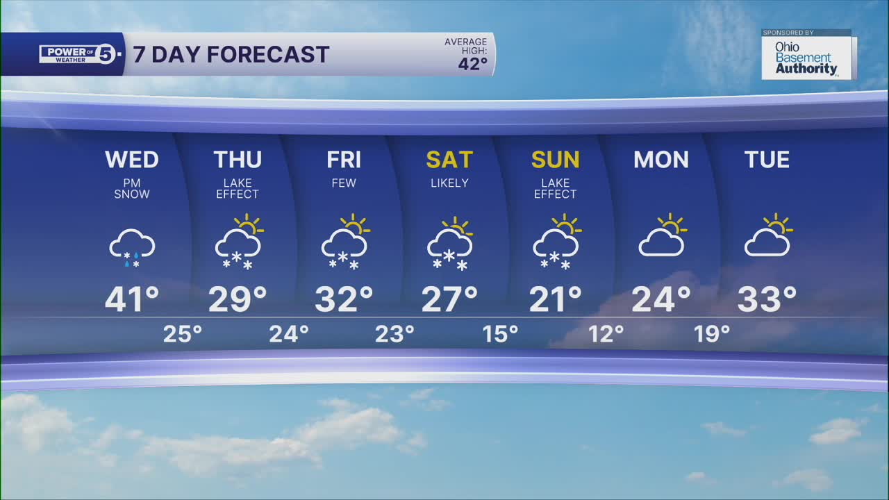
A cold front passes this afternoon and temperatures take a dive this evening. We're dropping back to freezing by sunset for most, with one final burst of snow likely, at a pretty bad time. Moderate snow is likely for most for the evening commute. It will start as a heavy wet snow that largely melts, but then starts to stick as temperatures fall below freezing. That means wet roads will freeze overnight with additional snow for some, especially in the primary snowbelt.
Lake effect will be the trend on Thursday and again on Friday. Brutally cold coming back as we wrap up the week. A clipper passes south of us Friday morning, with a quick coating or more to the south of Akron. More widespread snow will be possible on Saturday, with highs in the 20s. Coldest air of the season settles in for Sunday, along with a few snow showers. Highs might not even reach 20° for the first time since the end of February.
DAILY FORECAST:
Tonight: Snow ends, isolated lake effect. Much colder. | Low: 23º
Thursday: Cold with a few lake effect snow showers. | High: 30º
Friday: Cold with a few snow showers, especially south of Akron, in the morning. | High: 29º
Saturday: Cold with some snow likely. | High: 25º
Want the latest Power of 5 weather team updates wherever you go? Download the News 5 App free now: Apple|Android
Click here to view our interactive radar.
Follow the News 5 Weather Team:
Trent Magill: Facebook & Twitter
Katie McGraw: Facebook & Twitter
Phil Sakal: Facebook & Twitter
Allan Nosoff: Facebook & Twitter
