


CLEVELAND — It will be a dry and chilly start to the workweek before another storm approaches on Tuesday. Temperatures across the region will struggle to warm past 40 on Monday, especially north and east of Cleveland, where some lake effect clouds will stick around.
This next system is coming from the southwest and is something I am watching. Wet flakes will be possible on Tuesday morning for some of NEO, which could impact the morning commute. More scattered rain will be possible during the afternoon on Tuesday. This will be subject to change, with some models suggesting more of a southern impact, while others suggest an impact of the entire region. Temperatures will once again be chilly, with highs only around 40 on Tuesday.
Next significant rain chance holds off until late Thursday and Friday of next week, along with another surge of warmth.
DAILY FORECAST:
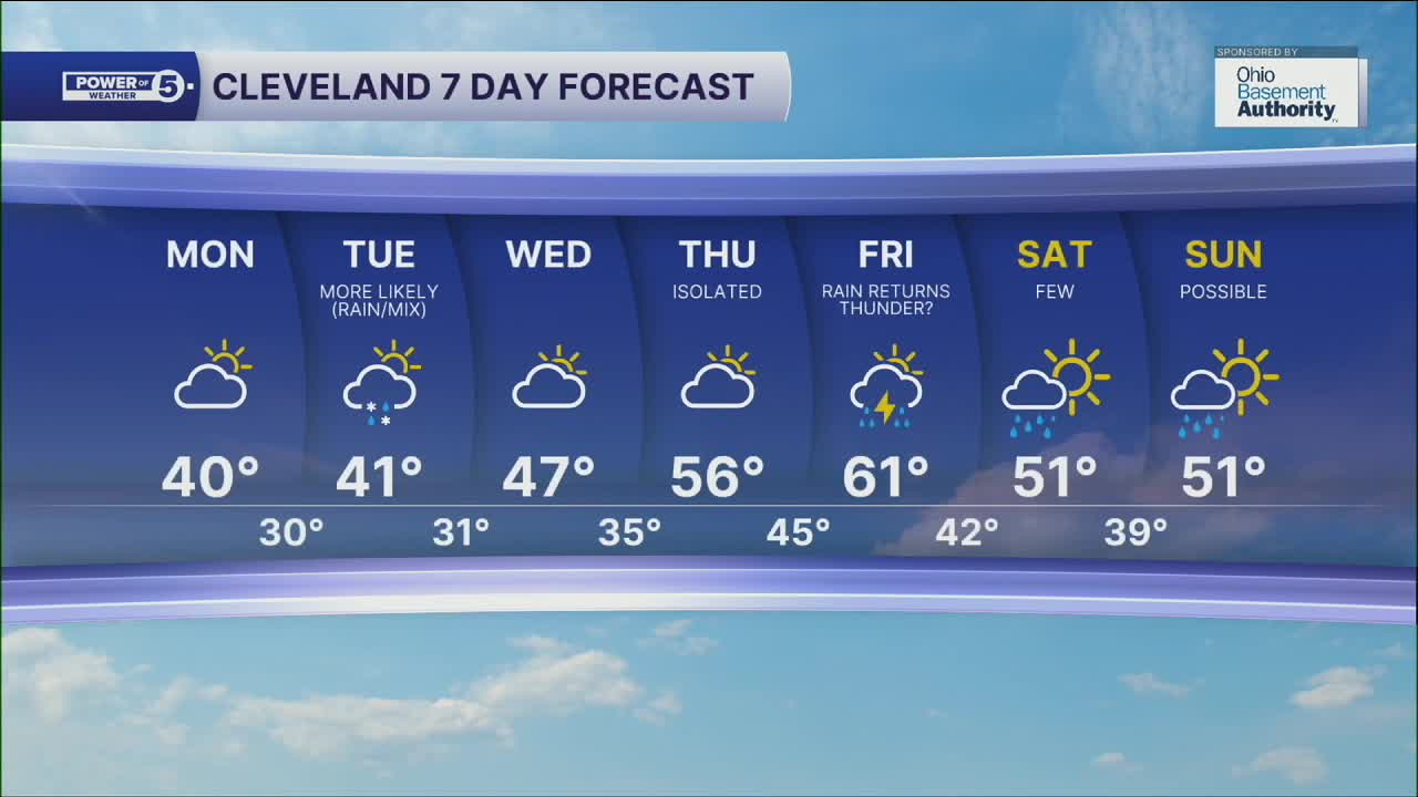
Monday: More sunshine. Breezy and Chilly. | High: 40º
Tuesday: Mostly cloudy with rain and wet snow showers. | High: 41º
Wednesday: Dry again. Warmer. | High: 47º
Thursday: Isolated showers possible late. Warmer and breezy. | High: 57º
Friday: More rain. Storms possible. Warm and breezy. | High: 61º
Saturday: Mostly cloudy. Few showers. Cooler. | High: 51º
Want the latest Power of 5 weather team updates wherever you go? Download the News 5 App free now: Apple|Android
Click here to view our interactive radar.
Follow the News 5 Weather Team:
Trent Magill: Facebook & Twitter
Katie McGraw: Facebook & Twitter
Phil Sakal: Facebook & Twitter
Allan Nosoff: Facebook & Twitter
