


CLEVELAND — After rounds of rain and a couple of storms, showers diminished this evening, but a few more showers and downpours are possible on Thursday.
Overnight will be mostly cloudy and will start dry with steady temperatures in the sixties. As an area of low pressure passes to our south, rain will return early on Thursday. These showers look steady but will likely only affect our southern and eastern communities and gradually slide east by about mid-morning.
Elsewhere, widely scattered/hit-and-miss showers and storms are expected on Thursday, but it will be much drier compared to Wednesday. We will likely even see a mixture of sun and clouds with temperatures in the 70s.
An isolated shower cannot be ruled out on Friday, but the forecast is trending drier and drier. This means that while there are a couple of chances to see more rain over the next two days, there will be several communities that have seen their last drop for days.
That's right! We are flipping the pattern back to dry and warm weather for the weekend and for the majority of the week to follow.
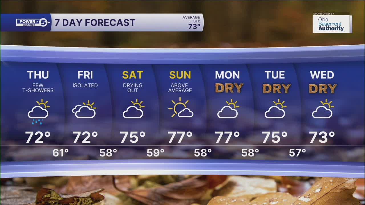
DAILY FORECAST:
Wednesday Night: Mostly cloudy. Steady temps.| Low: 63º
Thursday: A few t-showers, cooler.| High: 69º
Friday: Isolated t-showers.| High: 72º
Saturday: Looking much drier and seasonable.| High: 75º
Sunday: Sun is making a return! | High: 76º
Want the latest Power of 5 weather team updates wherever you go? Download the News 5 App free now: Apple|Android
Click here to view our interactive radar.
Follow the News 5 Weather Team:
Trent Magill: Facebook & Twitter
Katie McGraw: Facebook & Twitter
Phil Sakal: Facebook & Twitter
Allan Nosoff: Facebook & Twitter
