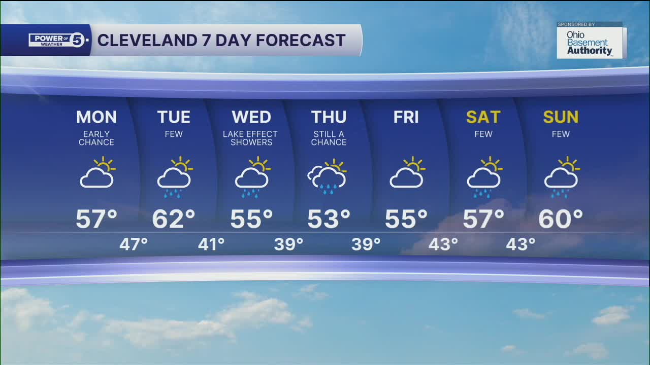


CLEVELAND — An isolated shower chance will be possible during the morning on Monday, with otherwise sunshine returning for the second half of the day. It will remain cooler and breezy, as highs only top off in the mid to upper 50s for many areas Monday afternoon.
Another round of showers will return by the middle of the week, as cooler air moves over a warm Lake Erie. This will bring more lake effect shower chances by Wednesday and Thursday, especially. Temperatures will remain well below average for most of the week, as highs will only top off in the mid to upper 50s.
Drier conditions move in by Friday, before more shower chances return for the weekend, as highs top off in the upper 50s to around 60.
DAILY FORECAST:
Monday: Early shower chance. Cooler again and still breezy. | High: 57º
Tuesday: Few showers. Seasonable. | High: 62º
Wednesday: Lake Effect Showers. Cooler again. | High: 55º
Thursday: Lingering showers. Coolest day. | High: 53º
Friday: Partly sunny. Not as cool but drier. | High: 55º
Saturday: Few showers. Touch warmer. | High: 57º
Sunday: Shower chances continue. | High: 60º
Want the latest Power of 5 weather team updates wherever you go? Download the News 5 App free now: Apple|Android
Click here to view our interactive radar.
Follow the News 5 Weather Team:
Trent Magill: Facebook & Twitter
Katie McGraw: Facebook & Twitter
Phil Sakal: Facebook & Twitter
Allan Nosoff: Facebook & Twitter
