

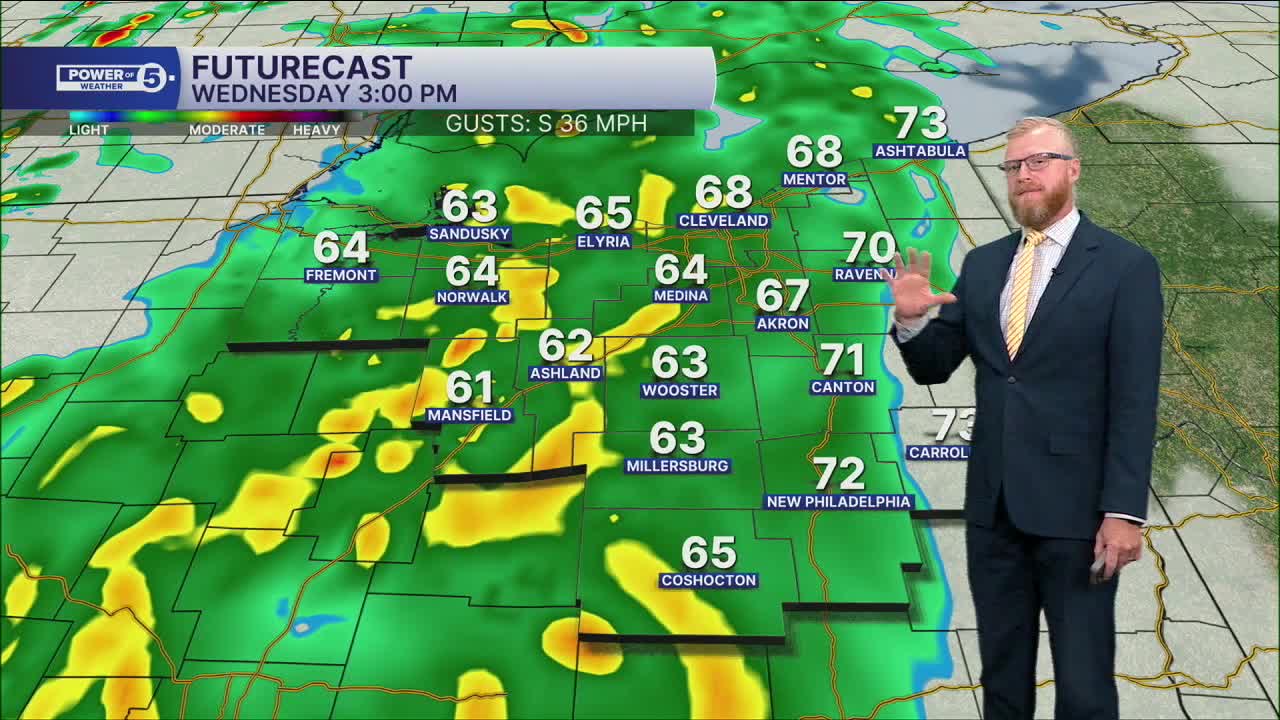


CLEVELAND — Yesterday’s 70s and sunshine are gone. Today turns wetter, windier and eventually cooler, with the biggest concern coming during the afternoon and PM drive.
Rain gets heavier this afternoon
We’ll still make a run at 70° today, but we get there early. Showers move in this morning, with steadier and heavier rain developing this afternoon. As the rain picks up, temps fall back through the 60s.
The rain itself may not be enough to cause major problems, but all those leaves clogging ditches and storm drains could slow down the water. That could lead to some ponding on roads and localized flooding, especially during the PM drive.
It’ll be windy, too. Gusts could reach 35 mph at times.
Rain winds down tonight
The steadiest rain tapers off this evening and overnight. A few isolated light showers could still be hanging around Thursday morning, but most of the day should be drier.
The bigger change Thursday is the cooler air. We’ll hold in the 50s all day.
Even chillier by the weekend
Friday and Saturday get another step colder, with lake-effect rain showers possible at times.
And if you’re making weekend plans, grab the heavier jacket. Afternoon temps only reach the 40s to near 50°. Quite a turnaround from yesterday’s sunshine and 70s.
5-Day Forecast:
Wednesday: Rain likely, heavy at times. | High: 70º
Thursday: Looking mostly dry but cooler. | High: 59º
Friday: Isolated showers. Even cooler. | High: 52°
Saturday: Isolated showers. Even cooler again. | High: 50º
Sunday: Looking drier, seasonable. | High: 54º
Learn the lingo: The Power of 5 Weather Team wants to get you your forecast closer to home. We have broken NEO into 5 separate and distinct regions. Find your region to get your hyper-local forecast!
- Cleveland Metro Region: Cuyahoga County. This region includes cities such as Cleveland, Parma, Westlake, Berea, Strongsville, Independence, Solon, Beachwood, and Euclid.
- Snowbelt Region: Lake, Geauga, and Ashtabula Counties. This includes cities such as Mentor, Geneva, Ashtabula, Bainbridge, Chardon, Burton, and Orwell.
- Akron-Canton Region: Summit, Stark, and Portage Counties. This region includes cities such as Akron, Canton, Hudson, Ravenna, Mantua, Alliance, and Canal Fulton.
- West Region: Lorain, Medina, Erie, Huron, Richland, and Ashland Counties. This region includes cities such as Lorain, Wellington, Medina, Lodi, Ashland, Mansfield, Willard, and Sandusky.
- South Region: Wayne, Holmes, Tuscarawas, Carroll Counties. This region includes Wooster, Millersburg, New Philadelphia, Strasburg, Mineral City, Carrollton, and Newcomerstown
You can send us photos and short videos by filling out the form below:
Want the latest Power of 5 weather team updates wherever you go? Download the News 5 App free now: Apple|Android
Click here to view our interactive radar.
Follow the News 5 Weather Team:
Trent Magill: Facebook & Twitter
Katie McGraw: Facebook & Twitter
Phil Sakal: Facebook & Twitter
Allan Nosoff: Facebook & Twitter
