


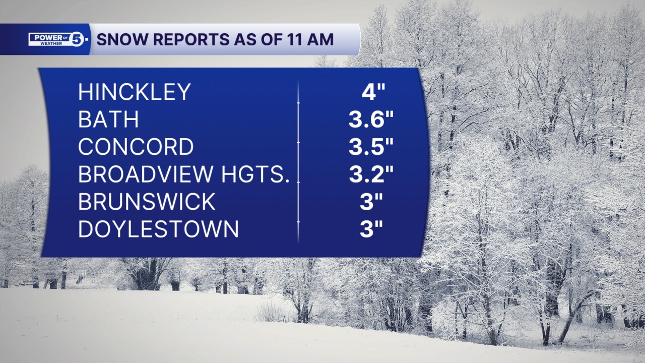
CLEVELAND — The start of your week has been snowy across Northeast Ohio. A few areas saw well over 2 inches of accumulation. And we are not done yet! Lake effect will continue on Tuesday.
News 5 Meteorologist Katie McGraw is live with Monday night updates:
Here's a look at Monday morning totals:
The Lake Effect Snow Machine was cranking again this evening across parts of Northeast Ohio, including portions of Lorain, Medina, Cuyahoga, and Geauga Counties, just in time for the evening. Northwest winds gusting to 30mph fueled that snowfall.
Squalls will continue into the second half of the evening in the primary snow belt. As winds become more westerly, the squall will begin to shift into far NE Ohio and NW PA overnight for a few hours. However, additional lake effect snow is expected on Tuesday morning until about midday. Figure around 7 am to 2 pm for the primary snowbelt.
Remember: *WHERE SQUALLS PERSIST*
-Up to 1" per hour snow
-Zero visibility
-Slick roads


A quick-moving disturbance will bring one more push of snow Tuesday evening from west to east, but accumulation looks minimal.
Apart from the snow, winds will remain gusty and produce Teens for Wind Chills across the region tonight. It will get even colder overnight. Single-digit wind chills will be possible in isolated spots after midnight.

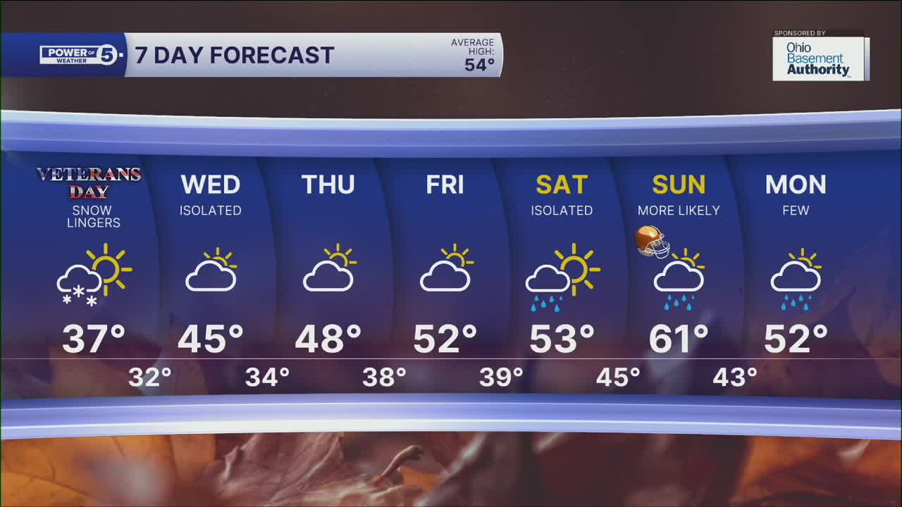
By Wednesday, temperatures will start to climb back into the 40s. A few lingering lake effect showers are expected, but this will be more of a rainy mix. We will finally dry out by Thursday and Friday with rising temperatures in the low 50s. 60s are possible this weekend! But the warm weather will also bring some wet weather. Keep this in mind for the Browns Game on Sunday!
DAILY FORECAST:
Monday Night: Lake effect snow. Very cold. | Low: 29º (feels like teens)
Tuesday: Lake Effect snow squalls (mainly east). | High: 38º (feels like 25-30º)
Wednesday: Stray leftover lake-effect shower. Partly sunny. Warmer. | High: 47º
Thursday: Dry. Partly sunny. | High: 49º
Friday: Partly sunny. Seasonable. | High: 50º
Saturday: Mostly cloudy. Warm. Chance of showers.| High: 56º
Want the latest Power of 5 weather team updates wherever you go? Download the News 5 App free now: Apple|Android
Click here to view our interactive radar.
Follow the News 5 Weather Team:
Trent Magill: Facebook & Twitter
Katie McGraw: Facebook & Twitter
Phil Sakal: Facebook & Twitter
Allan Nosoff: Facebook & Twitter
