


CLEVELAND — Temperatures fall close to the freezing mark overnight as a weak clipper could bring a few wet snow showers or a rain/snow mix to the Monday morning commute.
It remains dreary all day Monday with isolated showers and downpours into the afternoon and evening. Another clipper Monday night could drop a quick accumulation, as lows are expected to dip down to the upper 20s to near 30 degrees.
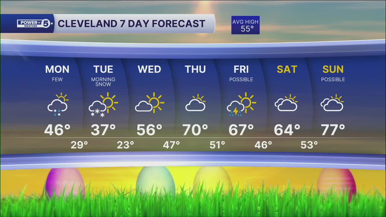
DAILY FORECAST:
Monday: Mix of snow and rain, chilly.| High: 46°
Tuesday: Mostly cloudy and cold. Morning snow showers.| High: 37°
Wednesday: Mostly sunny and warmer.| High: 56°
Thursday: Partly sunny and warmer.| High: 70°
Friday: Rain/Storms possible. Touch cooler.| High: 67°
Saturday: Partly sunny and dry.| High: 64°
Sunday: Rain possible and warmer.| High: 77°
Want the latest Power of 5 weather team updates wherever you go? Download the News 5 App free now: Apple|Android
Click here to view our interactive radar.
Follow the News 5 Weather Team:
Trent Magill: Facebook & Twitter
Katie McGraw: Facebook & Twitter
Phil Sakal: Facebook & Twitter
Allan Nosoff: Facebook & Twitter
