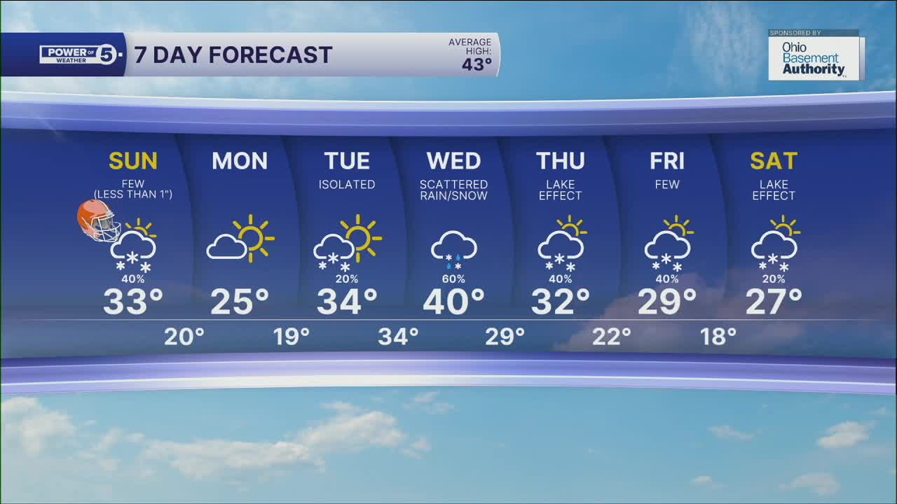


CLEVELAND — We're tracking snow again today. Wrapping up the weekend with minor slushy accumulations. No advisories, but roads could get slick. Temps holding near freezing all day, so today's snow will be a bit different from previous snows this season. These will be wet snowflakes... Plan on a slushy Trace to 1" with a slim shot at 2" in a couple places. Most stay under 1" today.
We're drying and clearing out this evening. Temps are actually diving also. We'll drop into the teens and 20s early Monday.
Get ready for another work week cold blast. We'll see more sun Monday, but temps struggle to rebound. Stuck in the 20s all day.
Tuesday should be a bit warmer, but the big "thaw" comes Wednesday. Most of us hit 40º for the first time this month. Might be the last time for a while, too... After Wednesday's scattered rain/snow showers, we drop again. Another blast wraps up the work week with more snow coming in tow.
DAILY FORECAST:
Sunday: Snow showers for the Browns game. | High: 33º
Monday: Cold and drier. | High: 25º
Tuesday: Few snow showers. Still cold. | High: 34º
Wednesday: Scattered rain/snow mix. | High: 40º
Thursday: Cold with a few lake effect snow showers. | High: 32º
Friday: Cold with a few snow showers. | High: 29º
Saturday: Cold with lake effect snow showers possible. | High: 27º
Want the latest Power of 5 weather team updates wherever you go? Download the News 5 App free now: Apple|Android
Click here to view our interactive radar.
Follow the News 5 Weather Team:
Trent Magill: Facebook & Twitter
Katie McGraw: Facebook & Twitter
Phil Sakal: Facebook & Twitter
Allan Nosoff: Facebook & Twitter
