


CLEVELAND — Get ready for a very active holiday forecast. Rain, snow, strong winds - oh my! For an in-depth look at the wintry holiday forecast...click this link.
- WIND ADVISORY: Issued for nearly all of Northeast Ohio through 4 am Thursday due to high winds. 20 to 30 mph with gusts up to 50 mph.
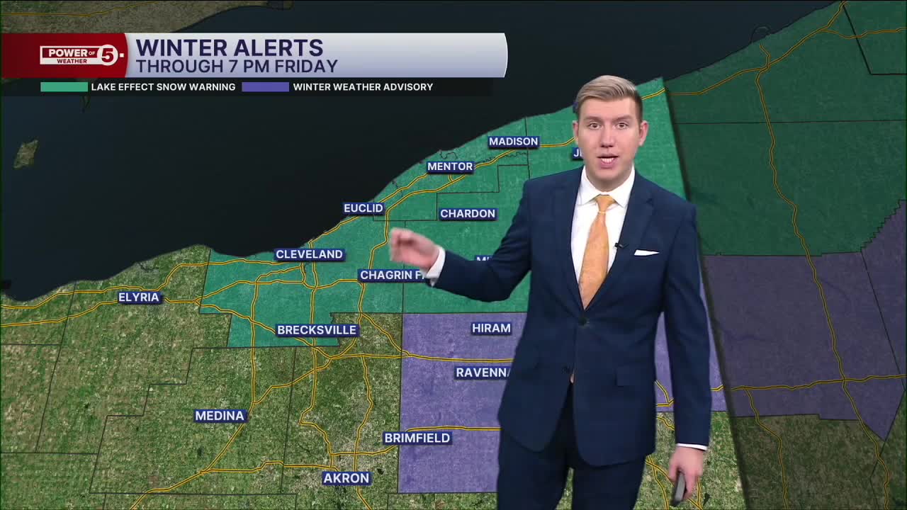
- LAKE EFFECT SNOW WARNING: Issued for Cuyahoga, Lake, Geauga, and Ashtabula Counties from Thursday morning through 7 p.m. Friday.
Temperatures will dip below freezing for most overnight, leading to some icy and slick spots on the roads, even before the snow arrives. The snow will arrive for coastal Lake and Ashtabula counties first by 3 a.m. and push inland and become a significant lake band of heavy snow through Thanksgiving morning.
Even though the Wind Advisory is set to expire at 4 a.m., gusts of over 35 or 40 mph are still expected through early Friday, possibly nearing 50 mph at the lakeshore.
Plan on heavy snow in squalls east of CLE and into the primary snowbelt on Thanksgiving and then eventually into the secondary belt later Thursday and Black Friday. Some communities could pick up over 12 inches of snow. This will impact travel over the holiday. Not only is snow expected, but it will still be blustery on Thursday and Friday. This could cause blowing and drifting snow, plus brutal wind chills in the teens.
Lake effect snow will gradually taper off on Black Friday, but we may get in on another round of rain and snow to finish out the Holiday Weekend, especially on Sunday. More on that round as we get into the end of the week.
DAILY FORECAST:
Tonight: Very cold and windy. Lake effect snow develops along the east side shoreline.| Low: 30º
Thanksgiving Day: Cold & windy with lake effect snow. | High: 33º
Friday: Less windy but still cold & snowy, especially Cleveland metro, points east and southeast. | High: 32º
Saturday: Snow showers possible late. Cold. | High: 35º
Want the latest Power of 5 weather team updates wherever you go? Download the News 5 App free now: Apple|Android
Click here to view our interactive radar.
Follow the News 5 Weather Team:
Trent Magill: Facebook & Twitter
Katie McGraw: Facebook & Twitter
Phil Sakal: Facebook & Twitter
Allan Nosoff: Facebook & Twitter
