


CLEVELAND — Winter weather is headed toward Northeast Ohio, just in time for Thanksgiving. Everyone will be dealing with brutally cold temperatures, strong winds and snow, but the snow is expected to pile up in the snowbelt.
Let's discuss timing, potential snowfall totals, and impacts to expect over the next three days.
ALERTS
The National Weather Service in Cleveland has upgraded the winter storm watch to a Lake Effect Snow Warning for Cuyahoga, Lake, Geauga, and Ashtabula counties. It goes into effect at 1 a.m. on Thursday and will remain in effect until 7 p.m. on Friday due to significant snowfall.
Heavy lake-effect snow is expected to intensify on Thursday morning and continue throughout Thanksgiving. Plan for accumulating snow and tricky to even dangerous travel conditions on Thursday and into Friday.

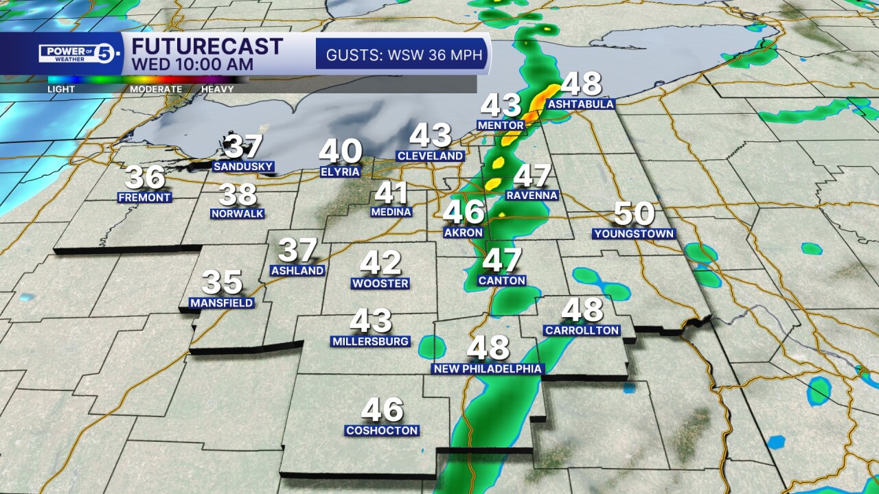
Additionally, a Wind Advisory has been issued for nearly all of Northeast Ohio from 10 a.m. Wednesday until 4 a.m. Thursday. Plan for southwest winds 20 to 30 mph with gusts up to 50 mph. Gusty winds will blow around unsecured objects, tree limbs could be blown down, and some power outages are possible.
Winds this strong can make driving difficult, especially for large vehicles. Use extra caution on the roads over the next few days.
Falling temperatures and strong winds will also make it feel VERY cold. Wind chills are expected to fall into the teens on Wednesday and remain there on Thanksgiving.
RELATED: Ohio Turnpike issues travel ban for high-profile vehicles ahead of Thanksgiving winter storm


TIMING
Wednesday starts mild, but do not be fooled by the temperatures out the door. Temperatures will crash by mid-morning from west to east from the 50s to the 40s to the 30s by late morning and early afternoon. It will be very windy as temperatures fall.
This will allow rain showers to change over to snow showers. While accumulation should be minor, a quick burst of snow could still result in slick/slippery roads for Wednesday afternoon and evening.

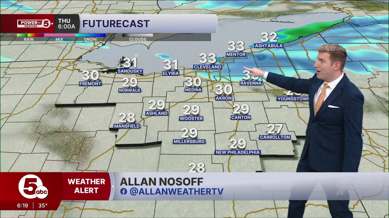
The lake effect snow machine is turned back on by Thanksgiving. The most intense snowfall is expected Thursday morning into the afternoon, with 1-2 inches of snow per hour possible.
Winds will still be strong on Thursday, which could result in low visibility or even whiteout conditions with visibility below a quarter of a mile. This all means that travel will be very difficult and dangerous in the snowbelt on Thursday and Friday
Keep in mind that lake-effect snow creates drastic differences in conditions, from heavy snow bands to dry weather, only miles apart. Even if the weather is fine at your house, be prepared for quick changes in weather, visibility and road conditions.
Lake effect snow is likely throughout the day on Thanksgiving and into Black Friday. Snow is expected to gradually taper off on Friday throughout the afternoon and evening.


SNOWFALL TOTALS
The Majority of Northeast Ohio will pick up less than 2 inches of snow.
This lake effect event looks to favor the heart of the primary snowbelt in far eastern Cuyahoga County, Geauga County, southern Lake County, and Ashtabula County. This is where 6 to 12 inches of snow will be possible. Some spots may even see over a foot of snow. Elsewhere in the snowbelt, totals will likely fall between 2 to 5 inches of snow and up to 6 inches in a few spots.
The Power of 5 Weather Team will be carefully monitoring the latest trends in the forecast over the next several days and will be sure to keep you posted on changes in the forecast. Be sure to check back for the latest information. Stay safe!

Want the latest Power of 5 weather team updates wherever you go? Download the News 5 App free now: Apple|Android
Click here to view our interactive radar.
Follow the News 5 Weather Team:
Trent Magill: Facebook & Twitter
Katie McGraw: Facebook & Twitter
Phil Sakal: Facebook & Twitter
Allan Nosoff: Facebook & Twitter
