


A FREEZE WARNING is in effect Tuesday evening until 10 am Tuesday.
Plan to grab the winter jacket tonight and tomorrow morning because temperatures will once again dip into the lower 30s and upper 20s. Winds picking up early Tuesday will cut that freeze short, though. Southerly gusts near 30mph will start just after sunrise on Tuesday. Temps will rebound QUICKLY! 30s to 60s within hours!
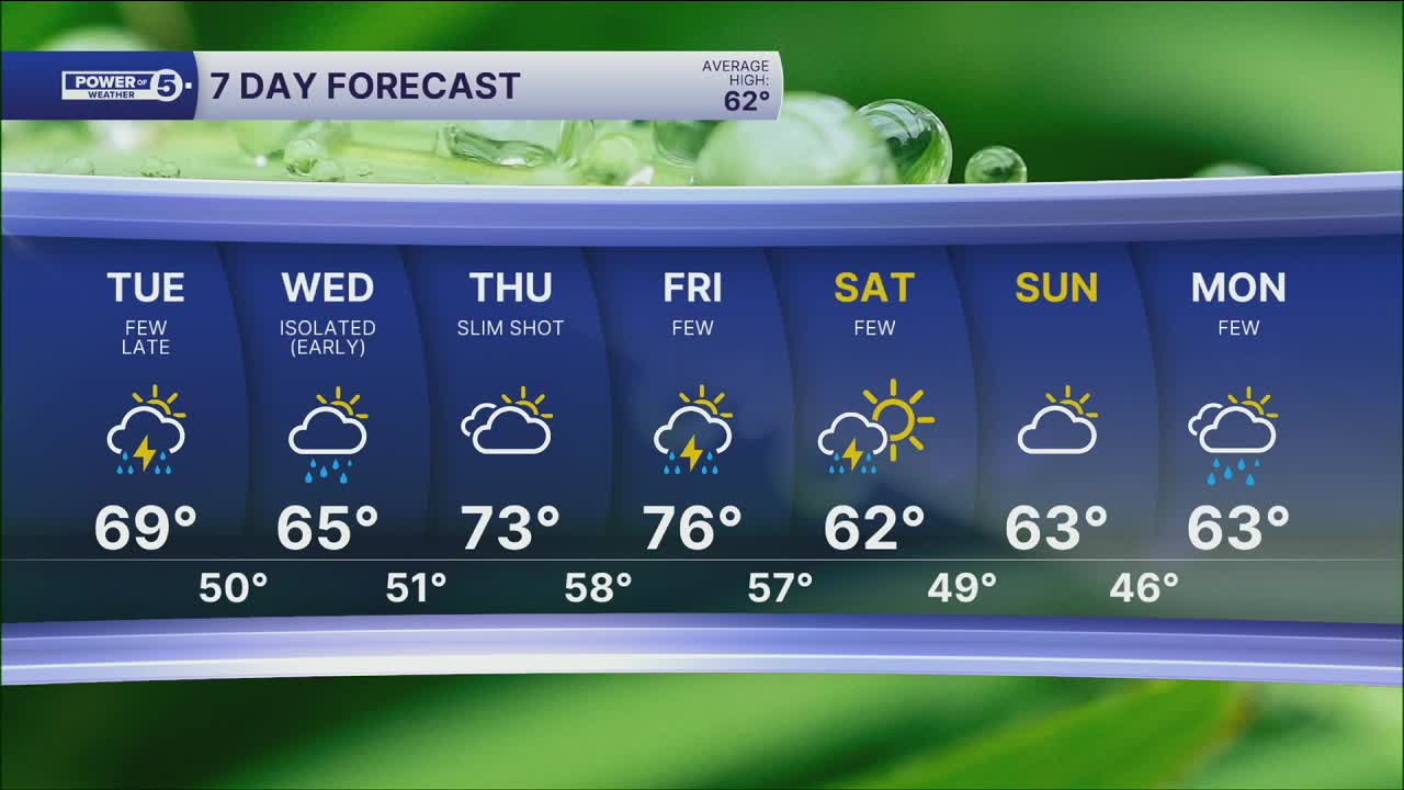
And we'll stay warm the rest of the week. Expect high temperatures in the 60s and 70s for the rest of the 7-Day forecast.
As winds and temperatures increase, so will clouds and rain chances. Most of the day is dry on Tuesday, but after the sun sets, a few t-showers will be possible Tuesday night and into Wednesday. Severe weather is not expected, with the highest chance for rain in our northern communities. We will dry out by Wednesday afternoon. After that, the next best chance for rain will be Friday evening.
DAILY FORECAST:
Monday Night: Cold & clear. | Low: 31º
Tuesday: Windy & warmer after another freezing start. A few evening t-showers. | High: 69º
Wednesday: Drying out after morning rain. | High: 67º
Thursday: Warm & breezy with a shot at rain. | High: 75º
Friday: Partly cloudy and warm. Storms at night. | High: 76º
Saturday: Storms possible, then turning colder. | High: 62º
Want the latest Power of 5 weather team updates wherever you go? Download the News 5 App free now: Apple|Android
Click here to view our interactive radar.
Follow the News 5 Weather Team:
Trent Magill: Facebook & Twitter
Katie McGraw: Facebook & Twitter
Phil Sakal: Facebook & Twitter
Allan Nosoff: Facebook & Twitter
