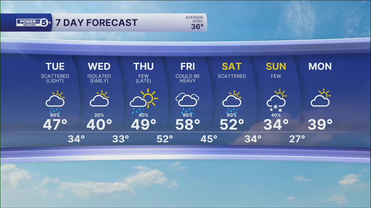


CLEVELAND — An isolated raindrop or snowflake mixing in will be possible early on Wednesday; otherwise, we are dry until late Thursday. Temperatures will be cooler on Wednesday, before the temperatures sore to round out the week.
Our next round of rain returns late Thursday into Friday. A warm front will bring the chance for rain Thursday evening, along with a bump in temperatures. Highs will be nearing 50 on Thursday.
More rain and warmth on-tap for Friday as highs approach 60, but anticipate more heavy rain, especially as a cold front moves through late Friday. Another area of low pressure moves along the front on Saturday, bringing more rain and keeping the warmth around.
Then, cold air comes crashing back down, switching the rain to snow on Sunday. Way too early for details and totals, but keep this in mind for weekend plans.
DAILY FORECAST:
Wednesday: Isolated AM Shower. Mostly Cloudy & Cooler. | High: 42º
Thursday: Warmer with a few rain showers late. | High: 48º
Friday: Warm and wet with heavy rain likely. Thunder? | High: 58º
Saturday: Scattered showers. Not as warm. | High: 52º
Sunday: Much colder. Few snow showers. | High: 34º
Monday: Mostly cloudy. Seasonable. | High: 39º
Tuesday: Mostly cloudy. Seasonable. | High: 38º
Want the latest Power of 5 weather team updates wherever you go? Download the News 5 App free now: Apple|Android
Click here to view our interactive radar.
Follow the News 5 Weather Team:
Trent Magill: Facebook & Twitter
Katie McGraw: Facebook & Twitter
Phil Sakal: Facebook & Twitter
Allan Nosoff: Facebook & Twitter
