


CLEVELAND — The temperature roller coaster continues!
Temperatures will be much colder for the second half of the weekend. Most areas will see low to mid 20s for temperatures most of the day on Sunday. Wind Chills, though, will once again be in the Teens and Single Digits on Sunday, as winds will be gusting as high as 30 mph at times. So bundle up as you're out and about on Sunday.
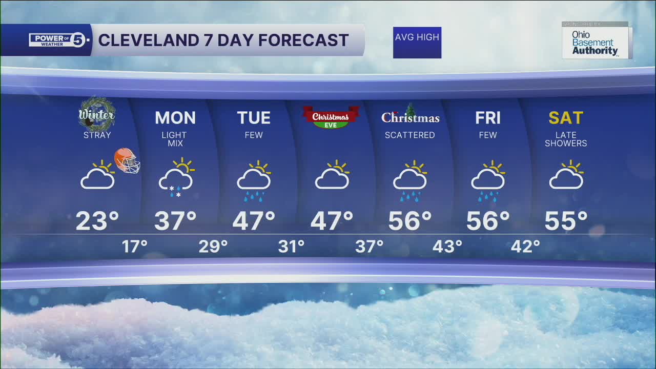
Another warm-up will move in on Tuesday through Friday, as highs climb into the 40s, 50s, and even close to 60 by Christmas Day! A few rain showers will be possible on Tuesday and Christmas Day will see more scattered showers. So it is looking more like a Muddy Christmas this year!
Mild temperatures and shower chances will linger into the day on Friday.
DAILY FORECAST:
Sunday: Mostly cloudy. Colder. | High: 23º
Monday: Light Mix. Mostly Cloudy. Chilly. | High: 37º
Tuesday: Few Rain Showers Possible. Warmer. | High: 47º
Christmas Eve: Mostly Cloudy. Mild. | High: 47º
Christmas Day: Scattered Showers. Warmer. | High: 56º
Friday: Few Showers. Warm Again. | High: 56º
Saturday: Rain Possible Late. Warm Again. | High: 55º
Want the latest Power of 5 weather team updates wherever you go? Download the News 5 App free now: Apple|Android
Click here to view our interactive radar.
Follow the News 5 Weather Team:
Trent Magill: Facebook & Twitter
Katie McGraw: Facebook & Twitter
Phil Sakal: Facebook & Twitter
Allan Nosoff: Facebook & Twitter
